Bodovaljci geodata
Bodovaljci (Slavonski Brod-Posavina) is a populated place; located in Croatia in Europe/Zagreb (GMT+2) time zone. With population of 552 people, there are 807 cities with bigger population in this country. Compared to other cities in Croatia, 66.9% of cities are located further ↑North; 75.2% of cities are located further ←West and 71% of cities have higher elevation than Bodovaljci. Note1


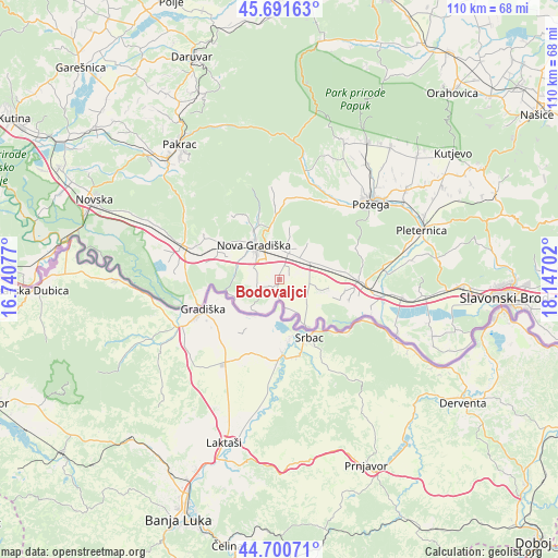
Bodovaljci GPS coordinates[2]
45° 11' 53.988" North, 17° 26' 38.004" East
| Map corner | latitude | longitude |
|---|---|---|
| Upper-left | 45.69163°, | 16.74077° |
| Center: | 45.19833°, | 17.44389° |
| Lower-right: | 44.70071°, | 18.14702° |
| Map W x H: | 110.2×110.2 km | = 68.5×68.5mi |
| max Lat: | 46.52694° ⇑66.9% North |
| Bodovaljci: | 45.19833° |
| min Lat: | ⇓33.1% South 42.54972° |
| min Long | Bodovaljci | max Long |
| 13.52389° | 17.44389° | 19.37694° |
| W 75.2%⇐ | ⇒24.8% E |
Elevation
Elevation of Bodovaljci is 93 m = 305 ft, and this is 60.3 m = 198 ft below average elevation for this country.
| Max E: |
827 m = 2713 ft | 71% |
| Avg. | 153.3 m = 503 ft | |
| Bodovaljci | 93 m = 305 ft | |
Min E: |
-1 m = -3 ft | 29% |
See also: Croatia elevation on elevation.city.
Geographical zone
Bodovaljci is located in North temperate zone (between Tropic of Cancer and the Arctic Circle). Distance of this North polar circle is 2375.6 km =1476.1 mi to North.| Distance of | km | miles | from Bodovaljci |
|---|---|---|---|
| North Pole | 4981.5 | 3095.4 | to North |
| Arctic Circle | 2375.6 | 1476.1 | to North |
| Tropic Cancer | 2419.7 | 1503.5 | to South |
| Equator | 5025.6 | 3122.8 | to South |


Nearby cities:
15 places around Bodovaljci: (largest is in red/bold)
• Adžamovci
5.7 km =3.5 mi,  16°
16°
• Cernik
11.1 km =6.9 mi,  334°
334°
• Davor
10.8 km =6.7 mi,  148°
148°
• Dragalić
13.2 km =8.2 mi,  292°
292°
• Godinjak
5.9 km =3.7 mi,  43°
43°
• Kovačevac
9.7 km =6 mi,  321°
321°
• Ljupina
5.2 km =3.2 mi, 294°
• Nova Gradiška
7.9 km =4.9 mi, 322°
• Orubica
5.7 km =3.5 mi,  168°
168°
• Prvča
8.3 km =5.2 mi,  307°
307°
• Rešetari
7.3 km =4.5 mi,  347°
347°
• Staro Petrovo Selo
7 km =4.3 mi,  58°
58°
• Vrbje
2.3 km =1.4 mi,  238°
238°
• Vrbova
10.7 km =6.6 mi,  77°
77°
• Štivica
7.8 km =4.8 mi,  101°
101°
Sources, notices
• [Note1] Compared only with cities in Croatia existing in our database
• [Src1] Map data: © OpenStreetMap contributors (CC-BY-SA)
• [Src2] Other city data from geonames.org with taken over terms of usage.
• [Src3] Geographical zone / Annual Mean Temperature by Robert A. Rohde @ Wikipedia
