Szentmártonkáta geodata
Szentmártonkáta (Pest) is a populated place; located in Hungary in Europe/Budapest (GMT+2) time zone. With population of 4,868 people, there are 306 cities with bigger population in this country. Compared to other cities in Hungary, 53% of cities are located further ↓South; 55.4% of cities are located further ←West and 51.5% of cities have lower elevation than Szentmártonkáta. Note1


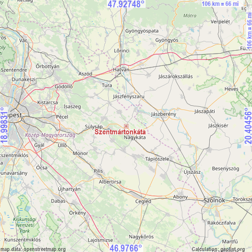
Szentmártonkáta GPS coordinates[2]
47° 27' 15.084" North, 19° 42' 5.148" East
| Map corner | latitude | longitude |
|---|---|---|
| Upper-left | 47.92748°, | 18.99831° |
| Center: | 47.45419°, | 19.70143° |
| Lower-right: | 46.9766°, | 20.40456° |
| Map W x H: | 105.7×105.7 km | = 65.7×65.7mi |
| max Lat: | 48.46667° ⇑47% North |
| Szentmártonkáta: | 47.45419° |
| min Lat: | ⇓53% South 45.79108° |
| min Long | Szentmártonká | max Long |
| 16.27358° | 19.70143° | 22.68096° |
| W 55.4%⇐ | ⇒44.6% E |
Elevation
Elevation of Szentmártonkáta is 117 m = 384 ft, and this is 12.7 m = 42 ft below average elevation for this country.
| Max E: |
444 m = 1457 ft | 48.5% |
| Avg. | 129.7 m = 426 ft | |
| Szentmártonkáta | 117 m = 384 ft | |
Min E: |
71 m = 233 ft | 51.5% |
See also: Hungary elevation on elevation.city.
Geographical zone
Szentmártonkáta is located in North temperate zone (between Tropic of Cancer and the Arctic Circle). Distance of this North polar circle is 2124.8 km =1320.3 mi to North.| Distance of | km | miles | from Szentmártonkáta |
|---|---|---|---|
| North Pole | 4730.7 | 2939.5 | to North |
| Arctic Circle | 2124.8 | 1320.3 | to North |
| Tropic Cancer | 2670.5 | 1659.4 | to South |
| Equator | 5276.4 | 3278.6 | to South |


Nearby cities:
15 places around Szentmártonkáta: (largest is in red/bold)
• Dány
13.9 km =8.6 mi,  301°
301°
• Farmos
15.1 km =9.4 mi,  133°
133°
• Forrópuszta
3.1 km =1.9 mi,  271°
271°
• Kóka
9.9 km =6.2 mi,  290°
290°
• Nagykáta
5.4 km =3.4 mi,  143°
143°
• Pánd
12.3 km =7.6 mi,  203°
203°
• Szentlőrinckáta
8.2 km =5.1 mi,  28°
28°
• Sülysáp
12.6 km =7.8 mi, 268°
• Tápióbicske
10.4 km =6.5 mi,  186°
186°
• Tápiószecső
6.9 km =4.3 mi, 266°
• Tápiószentmárton
13.2 km =8.2 mi,  165°
165°
• Tápióság
7.9 km =4.9 mi,  222°
222°
• Tóalmás
6.5 km =4 mi,  336°
336°
• Zsámbok
12.1 km =7.5 mi,  325°
325°
• Úri
13.8 km =8.6 mi,  251°
251°
Sources, notices
• [Note1] Compared only with cities in Hungary existing in our database
• [Src1] Map data: © OpenStreetMap contributors (CC-BY-SA)
• [Src2] Other city data from geonames.org with taken over terms of usage.
• [Src3] Geographical zone / Annual Mean Temperature by Robert A. Rohde @ Wikipedia
