Tuzsér geodata
Tuzsér (Szabolcs-Szatmár-Bereg) is a populated place; located in Hungary in Europe/Budapest (GMT+2) time zone. With population of 3,332 people, there are 438 cities with bigger population in this country. Compared to other cities in Hungary, 99.3% of cities are located further ↓South; 96.6% of cities are located further ←West and 70.8% of cities have higher elevation than Tuzsér. Note1


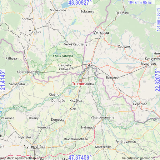
Tuzsér GPS coordinates[2]
48° 20' 38.652" North, 22° 7' 3.432" East
| Map corner | latitude | longitude |
|---|---|---|
| Upper-left | 48.80927°, | 21.4145° |
| Center: | 48.34407°, | 22.11762° |
| Lower-right: | 47.87459°, | 22.82075° |
| Map W x H: | 103.9×103.9 km | = 64.6×64.6mi |
| max Lat: | 48.46667° ⇑0.7% North |
| Tuzsér: | 48.34407° |
| min Lat: | ⇓99.3% South 45.79108° |
| min Long | Tuzsér | max Long |
| 16.27358° | 22.11762° | 22.68096° |
| W 96.6%⇐ | ⇒3.4% E |
Elevation
Elevation of Tuzsér is 101 m = 331 ft, and this is 28.7 m = 94 ft below average elevation for this country.
| Max E: |
444 m = 1457 ft | 70.8% |
| Avg. | 129.7 m = 426 ft | |
| Tuzsér | 101 m = 331 ft | |
Min E: |
71 m = 233 ft | 29.2% |
See also: Hungary elevation on elevation.city.
Geographical zone
Tuzsér is located in North temperate zone (between Tropic of Cancer and the Arctic Circle). Distance of this North polar circle is 2025.8 km =1258.8 mi to North.| Distance of | km | miles | from Tuzsér |
|---|---|---|---|
| North Pole | 4631.7 | 2878 | to North |
| Arctic Circle | 2025.8 | 1258.8 | to North |
| Tropic Cancer | 2769.4 | 1720.8 | to South |
| Equator | 5375.4 | 3340.1 | to South |


Nearby cities:
15 places around Tuzsér: (largest is in red/bold)
• Ajak
19.1 km =11.9 mi,  192°
192°
• Anarcs
18.6 km =11.6 mi,  181°
181°
• Aranyosapáti
18.6 km =11.6 mi,  145°
145°
• Cigánd
19.4 km =12.1 mi,  239°
239°
• Dombrád
18.4 km =11.4 mi,  227°
227°
• Döge
9.9 km =6.2 mi,  203°
203°
• Fényeslitke
8.2 km =5.1 mi, 189°
• Gyulaháza
23.4 km =14.5 mi, 180°
• Kisvárda
14.4 km =8.9 mi, 190°
• Mándok
6 km =3.7 mi,  114°
114°
• Pátroha
21.6 km =13.4 mi, 203°
• Ricse
11.1 km =6.9 mi,  259°
259°
• Tiszabezdéd
3.5 km =2.2 mi,  43°
43°
• Tornyospálca
9.9 km =6.2 mi, 150°
• Záhony
8.4 km =5.2 mi,  30°
30°
Sources, notices
• [Note1] Compared only with cities in Hungary existing in our database
• [Src1] Map data: © OpenStreetMap contributors (CC-BY-SA)
• [Src2] Other city data from geonames.org with taken over terms of usage.
• [Src3] Geographical zone / Annual Mean Temperature by Robert A. Rohde @ Wikipedia
