Kaszaper geodata
Kaszaper (Bekes) is a populated place; located in Hungary in Europe/Budapest (GMT+2) time zone. With population of 2,063 people, there are 754 cities with bigger population in this country. Compared to other cities in Hungary, 86.8% of cities are located further ↑North; 77.5% of cities are located further ←West and 85.5% of cities have higher elevation than Kaszaper. Note1


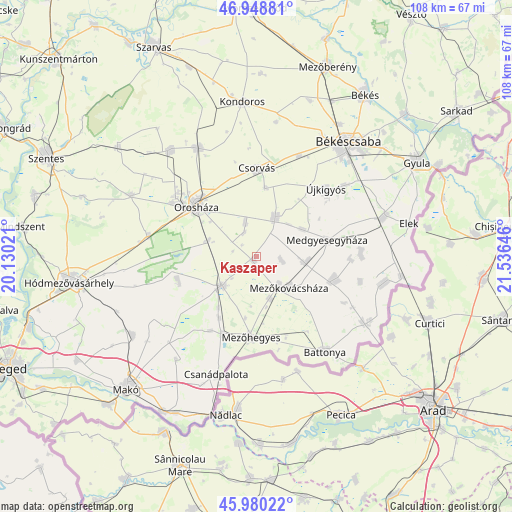
Kaszaper GPS coordinates[2]
46° 28' 0.012" North, 20° 49' 59.988" East
| Map corner | latitude | longitude |
|---|---|---|
| Upper-left | 46.94881°, | 20.13021° |
| Center: | 46.46667°, | 20.83333° |
| Lower-right: | 45.98022°, | 21.53646° |
| Map W x H: | 107.7×107.7 km | = 66.9×66.9mi |
| max Lat: | 48.46667° ⇑86.8% North |
| Kaszaper: | 46.46667° |
| min Lat: | ⇓13.2% South 45.79108° |
| min Long | Kaszaper | max Long |
| 16.27358° | 20.83333° | 22.68096° |
| W 77.5%⇐ | ⇒22.5% E |
Elevation
Elevation of Kaszaper is 90 m = 295 ft, and this is 39.7 m = 130 ft below average elevation for this country.
| Max E: |
444 m = 1457 ft | 85.5% |
| Avg. | 129.7 m = 426 ft | |
| Kaszaper | 90 m = 295 ft | |
Min E: |
71 m = 233 ft | 14.5% |
See also: Hungary elevation on elevation.city.
Geographical zone
Kaszaper is located in North temperate zone (between Tropic of Cancer and the Arctic Circle). Distance of this North polar circle is 2234.6 km =1388.5 mi to North.| Distance of | km | miles | from Kaszaper |
|---|---|---|---|
| North Pole | 4840.5 | 3007.7 | to North |
| Arctic Circle | 2234.6 | 1388.5 | to North |
| Tropic Cancer | 2560.7 | 1591.1 | to South |
| Equator | 5166.6 | 3210.4 | to South |


Nearby cities:
15 places around Kaszaper: (largest is in red/bold)
• Ambrózfalva
15.1 km =9.4 mi,  210°
210°
• Battonya
24.8 km =15.4 mi,  145°
145°
• Békéssámson
16.3 km =10.1 mi,  250°
250°
• Csanádapáca
10 km =6.2 mi,  22°
22°
• Csorvás
18.5 km =11.5 mi,  0°
0°
• Kunágota
17 km =10.6 mi,  102°
102°
• Magyarbánhegyes
10.4 km =6.5 mi, 100°
• Medgyesegyháza
15.8 km =9.8 mi,  76°
76°
• Mezőhegyes
16.7 km =10.4 mi,  184°
184°
• Mezőkovácsháza
9.8 km =6.1 mi,  139°
139°
• Orosháza
16.9 km =10.5 mi,  311°
311°
• Pusztaföldvár
7.8 km =4.8 mi,  341°
341°
• Székkutas
23.3 km =14.5 mi,  279°
279°
• Tótkomlós
9.5 km =5.9 mi,  234°
234°
• Újkígyós
20.1 km =12.5 mi,  49°
49°
Sources, notices
• [Note1] Compared only with cities in Hungary existing in our database
• [Src1] Map data: © OpenStreetMap contributors (CC-BY-SA)
• [Src2] Other city data from geonames.org with taken over terms of usage.
• [Src3] Geographical zone / Annual Mean Temperature by Robert A. Rohde @ Wikipedia
