Székkutas geodata
Székkutas (Csongrád) is a populated place; located in Hungary in Europe/Budapest (GMT+2) time zone. With population of 2,586 people, there are 597 cities with bigger population in this country. Compared to other cities in Hungary, 86% of cities are located further ↑North; 72% of cities are located further ←West and 96.4% of cities have higher elevation than Székkutas. Note1


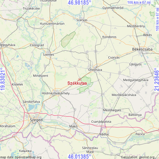
Székkutas GPS coordinates[2]
46° 30' 0" North, 20° 31' 59.988" East
| Map corner | latitude | longitude |
|---|---|---|
| Upper-left | 46.98185°, | 19.83021° |
| Center: | 46.5°, | 20.53333° |
| Lower-right: | 46.01385°, | 21.23646° |
| Map W x H: | 107.6×107.6 km | = 66.9×66.9mi |
| max Lat: | 48.46667° ⇑86% North |
| Székkutas: | 46.5° |
| min Lat: | ⇓14% South 45.79108° |
| min Long | Székkutas | max Long |
| 16.27358° | 20.53333° | 22.68096° |
| W 72%⇐ | ⇒28% E |
Elevation
Elevation of Székkutas is 83 m = 272 ft, and this is 46.7 m = 153 ft below average elevation for this country.
| Max E: |
444 m = 1457 ft | 96.4% |
| Avg. | 129.7 m = 426 ft | |
| Székkutas | 83 m = 272 ft | |
Min E: |
71 m = 233 ft | 3.6% |
See also: Hungary elevation on elevation.city.
Geographical zone
Székkutas is located in North temperate zone (between Tropic of Cancer and the Arctic Circle). Distance of this North polar circle is 2230.9 km =1386.2 mi to North.| Distance of | km | miles | from Székkutas |
|---|---|---|---|
| North Pole | 4836.7 | 3005.4 | to North |
| Arctic Circle | 2230.9 | 1386.2 | to North |
| Tropic Cancer | 2564.4 | 1593.4 | to South |
| Equator | 5170.3 | 3212.7 | to South |


Nearby cities:
15 places around Székkutas: (largest is in red/bold)
• Ambrózfalva
22.7 km =14.1 mi,  137°
137°
• Békéssámson
12 km =7.5 mi, 140°
• Csanádapáca
27.3 km =17 mi,  78°
78°
• Csorvás
27.3 km =17 mi,  57°
57°
• Fábiánsebestyén
21 km =13 mi,  345°
345°
• Földeák
20.5 km =12.7 mi,  187°
187°
• Gádoros
19.2 km =11.9 mi,  15°
15°
• Hódmezővásárhely
17.9 km =11.1 mi,  238°
238°
• Kaszaper
23.3 km =14.5 mi,  99°
99°
• Mindszent
26.4 km =16.4 mi,  275°
275°
• Nagyszénás
22.8 km =14.2 mi,  26°
26°
• Orosháza
12.6 km =7.8 mi,  53°
53°
• Pusztaföldvár
20.7 km =12.9 mi, 79°
• Szegvár
25.6 km =15.9 mi,  292°
292°
• Tótkomlós
17.9 km =11.1 mi,  121°
121°
Sources, notices
• [Note1] Compared only with cities in Hungary existing in our database
• [Src1] Map data: © OpenStreetMap contributors (CC-BY-SA)
• [Src2] Other city data from geonames.org with taken over terms of usage.
• [Src3] Geographical zone / Annual Mean Temperature by Robert A. Rohde @ Wikipedia
