Kál geodata
Kál (Heves) is a populated place; located in Hungary in Europe/Budapest (GMT+2) time zone. With population of 3,683 people, there are 402 cities with bigger population in this country. Compared to other cities in Hungary, 73.2% of cities are located further ↓South; 67.6% of cities are located further ←West and 50.7% of cities have lower elevation than Kál. Note1


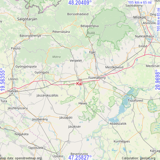
Kál GPS coordinates[2]
47° 43' 59.988" North, 20° 16' 0.012" East
| Map corner | latitude | longitude |
|---|---|---|
| Upper-left | 48.20409°, | 19.56355° |
| Center: | 47.73333°, | 20.26667° |
| Lower-right: | 47.25827°, | 20.9698° |
| Map W x H: | 105.2×105.2 km | = 65.4×65.4mi |
| max Lat: | 48.46667° ⇑26.8% North |
| Kál: | 47.73333° |
| min Lat: | ⇓73.2% South 45.79108° |
| min Long | Kál | max Long |
| 16.27358° | 20.26667° | 22.68096° |
| W 67.6%⇐ | ⇒32.4% E |
Elevation
Elevation of Kál is 116 m = 381 ft, and this is 13.7 m = 45 ft below average elevation for this country.
| Max E: |
444 m = 1457 ft | 49.3% |
| Avg. | 129.7 m = 426 ft | |
| Kál | 116 m = 381 ft | |
Min E: |
71 m = 233 ft | 50.7% |
See also: Hungary elevation on elevation.city.
Geographical zone
Kál is located in North temperate zone (between Tropic of Cancer and the Arctic Circle). Distance of this North polar circle is 2093.7 km =1301 mi to North.| Distance of | km | miles | from Kál |
|---|---|---|---|
| North Pole | 4699.6 | 2920.2 | to North |
| Arctic Circle | 2093.7 | 1301 | to North |
| Tropic Cancer | 2701.5 | 1678.6 | to South |
| Equator | 5307.4 | 3297.9 | to South |


Nearby cities:
15 places around Kál: (largest is in red/bold)
• Andornaktálya
17.1 km =10.6 mi,  40°
40°
• Besenyőtelek
13 km =8.1 mi,  106°
106°
• Domoszló
15.8 km =9.8 mi,  314°
314°
• Egerszalók
15.6 km =9.7 mi,  18°
18°
• Erdőtelek
6.7 km =4.2 mi,  146°
146°
• Füzesabony
11.4 km =7.1 mi,  80°
80°
• Heves
14.9 km =9.3 mi,  175°
175°
• Jászszentandrás
17.8 km =11.1 mi,  200°
200°
• Karácsond
17.6 km =10.9 mi,  268°
268°
• Kerecsend
9.7 km =6 mi, 40°
• Kompolt
1.2 km =0.7 mi, 270°
• Maklár
13.4 km =8.3 mi,  56°
56°
• Ostoros
19.4 km =12.1 mi, 40°
• Szihalom
16.6 km =10.3 mi, 77°
• Verpelét
13.2 km =8.2 mi,  349°
349°
Sources, notices
• [Note1] Compared only with cities in Hungary existing in our database
• [Src1] Map data: © OpenStreetMap contributors (CC-BY-SA)
• [Src2] Other city data from geonames.org with taken over terms of usage.
• [Src3] Geographical zone / Annual Mean Temperature by Robert A. Rohde @ Wikipedia
