Nilulat geodata
Nilulat (East Nusa Tenggara) is a seat of a fourth-order administrative division; located in Indonesia in Asia/Makassar (GMT+8) time zone. In our database, there are 407 cities with bigger population. Compared to other cities in Indonesia, 93% of cities are located further ↑North; 95.6% of cities are located further ←West and 97.8% of cities have lower elevation than Nilulat. Note1


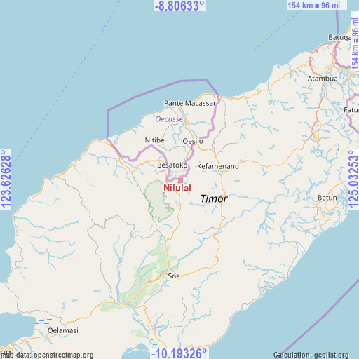
Nilulat GPS coordinates[2]
9° 30' 1.8" South, 124° 19' 45.84" East
| Map corner | latitude | longitude |
|---|---|---|
| Upper-left | -8.80633°, | 123.62628° |
| Center: | -9.5005°, | 124.3294° |
| Lower-right: | -10.19326°, | 125.03253° |
| Map W x H: | 154.2×154.2 km | = 95.8×95.8mi |
| max Lat: | 5.88969° ⇑93% North |
| Nilulat: | -9.5005° |
| min Lat: | ⇓7% South -10.934° |
| min Long | Nilulat | max Long |
| 95.1345° | 124.3294° | 140.9419° |
| W 95.6%⇐ | ⇒4.4% E |
Elevation
Elevation of Nilulat is 1015 m = 3330 ft, and this is 785.3 m = 2576 ft above average elevation for this country.
| Max E: |
3185 m = 10449 ft | 2.2% |
| Nilulat | 1015 m 3330 ft | |
| Avg. | 229.7 m = 754 ft | |
Min E: |
-1 m = -3 ft | 97.8% |
See also: Indonesia elevation on elevation.city.
Geographical zone
Nilulat is located in South Torrid zone (between Equator and Tropic of Capricorn). Distance of Equator is 1056.4 km =656.4 mi to North.| Distance of | km | miles | from Nilulat |
|---|---|---|---|
| Equator | 1056.4 | 656.4 | to North |
| Tropic Capricorn | 1549.6 | 962.9 | to South |
| Antarctic Circle | 6344.8 | 3942.5 | to South |
| South Pole | 8950.7 | 5561.7 | to South |


Nearby cities:
15 places around Nilulat: (largest is in red/bold)
• Basan
5.3 km =3.3 mi,  65°
65°
• Binab
10.2 km =6.3 mi,  205°
205°
• Eban
6 km =3.7 mi,  185°
185°
• Fatufaun
5.8 km =3.6 mi, 193°
• Metkono
10.1 km =6.3 mi,  115°
115°
• Muesanaik
4.5 km =2.8 mi,  101°
101°
• Noeltoko
5.3 km =3.3 mi,  141°
141°
• Nunpo
3.4 km =2.1 mi,  60°
60°
• Oebaki
8.5 km =5.3 mi,  134°
134°
• Oenaek
6.8 km =4.2 mi, 213°
• Oenaik
8.3 km =5.2 mi,  159°
159°
• Oesena
7.4 km =4.6 mi, 214°
• Saenam
5.3 km =3.3 mi, 212°
• Seoam
6.1 km =3.8 mi,  178°
178°
• Suanae
7.1 km =4.4 mi, 176°
Sources, notices
• [Note1] Compared only with cities in Indonesia existing in our database
• [Src1] Map data: © OpenStreetMap contributors (CC-BY-SA)
• [Src2] Other city data from geonames.org with taken over terms of usage.
• [Src3] Geographical zone / Annual Mean Temperature by Robert A. Rohde @ Wikipedia
