Plaosan geodata
Plaosan (East Java) is a seat of a fourth-order administrative division; located in Indonesia in Asia/Jakarta (GMT+7) time zone. In our database, there are 407 cities with bigger population. Compared to other cities in Indonesia, 65.2% of cities are located further ↑North; 55.2% of cities are located further ←West and 79.8% of cities have lower elevation than Plaosan. Note1


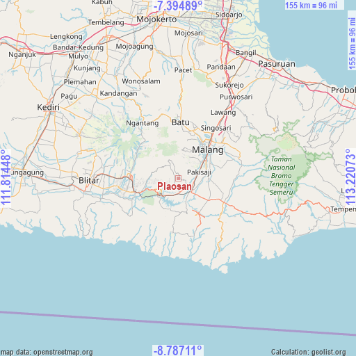
Plaosan GPS coordinates[2]
8° 5' 29.76" South, 112° 31' 3.36" East
| Map corner | latitude | longitude |
|---|---|---|
| Upper-left | -7.39489°, | 111.81448° |
| Center: | -8.0916°, | 112.5176° |
| Lower-right: | -8.78711°, | 113.22073° |
| Map W x H: | 154.8×154.8 km | = 96.2×96.2mi |
| max Lat: | 5.88969° ⇑65.2% North |
| Plaosan: | -8.0916° |
| min Lat: | ⇓34.8% South -10.934° |
| min Long | Plaosan | max Long |
| 95.1345° | 112.5176° | 140.9419° |
| W 55.2%⇐ | ⇒44.8% E |
Elevation
Elevation of Plaosan is 429 m = 1407 ft, and this is 199.3 m = 654 ft above average elevation for this country.
| Max E: |
3185 m = 10449 ft | 20.2% |
| Plaosan | 429 m 1407 ft | |
| Avg. | 229.7 m = 754 ft | |
Min E: |
-1 m = -3 ft | 79.8% |
See also: Indonesia elevation on elevation.city.
Geographical zone
Plaosan is located in South Torrid zone (between Equator and Tropic of Capricorn). Distance of Equator is 899.7 km =559 mi to North.| Distance of | km | miles | from Plaosan |
|---|---|---|---|
| Equator | 899.7 | 559 | to North |
| Tropic Capricorn | 1706.2 | 1060.2 | to South |
| Antarctic Circle | 6501.5 | 4039.8 | to South |
| South Pole | 9107.4 | 5659.1 | to South |


Nearby cities:
15 places around Plaosan: (largest is in red/bold)
• Bangelan
2.4 km =1.5 mi,  241°
241°
• Jatikerto
5.5 km =3.4 mi,  155°
155°
• Jatirejo
5.1 km =3.2 mi,  218°
218°
• Kertorejo
5.4 km =3.4 mi,  249°
249°
• Krandil
3.6 km =2.2 mi,  228°
228°
• Kromengan
5.1 km =3.2 mi,  214°
214°
• Maguan
3.1 km =1.9 mi,  43°
43°
• Mboto
5.6 km =3.5 mi,  89°
89°
• Ngasem
4.6 km =2.9 mi,  95°
95°
• Ngrejo
1.9 km =1.2 mi, 234°
• Palaan
3.6 km =2.2 mi,  113°
113°
• Plandi
2.1 km =1.3 mi,  189°
189°
• Talangagung
5.5 km =3.4 mi,  133°
133°
• Tempursari Wetan
5.4 km =3.4 mi,  323°
323°
• Tumpangrejo
2.8 km =1.7 mi,  354°
354°
Sources, notices
• [Note1] Compared only with cities in Indonesia existing in our database
• [Src1] Map data: © OpenStreetMap contributors (CC-BY-SA)
• [Src2] Other city data from geonames.org with taken over terms of usage.
• [Src3] Geographical zone / Annual Mean Temperature by Robert A. Rohde @ Wikipedia
