Ngadilangkung geodata
Ngadilangkung (East Java) is a seat of a fourth-order administrative division; located in Indonesia in Asia/Jakarta (GMT+7) time zone. In our database, there are 407 cities with bigger population. Compared to other cities in Indonesia, 65.9% of cities are located further ↑North; 55.8% of cities are located further ←West and 74.9% of cities have lower elevation than Ngadilangkung. Note1


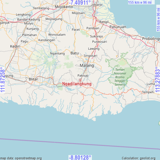
Ngadilangkung GPS coordinates[2]
8° 6' 20.88" South, 112° 34' 32.52" East
| Map corner | latitude | longitude |
|---|---|---|
| Upper-left | -7.40911°, | 111.87258° |
| Center: | -8.1058°, | 112.5757° |
| Lower-right: | -8.80128°, | 113.27883° |
| Map W x H: | 154.8×154.8 km | = 96.2×96.2mi |
| max Lat: | 5.88969° ⇑65.9% North |
| Ngadilangkung: | -8.1058° |
| min Lat: | ⇓34.1% South -10.934° |
| min Long | Ngadilangkung | max Long |
| 95.1345° | 112.5757° | 140.9419° |
| W 55.8%⇐ | ⇒44.2% E |
Elevation
Elevation of Ngadilangkung is 358 m = 1175 ft, and this is 128.3 m = 421 ft above average elevation for this country.
| Max E: |
3185 m = 10449 ft | 25.1% |
| Ngadilangkung | 358 m 1175 ft | |
| Avg. | 229.7 m = 754 ft | |
Min E: |
-1 m = -3 ft | 74.9% |
See also: Indonesia elevation on elevation.city.
Geographical zone
Ngadilangkung is located in South Torrid zone (between Equator and Tropic of Capricorn). Distance of Equator is 901.3 km =560 mi to North.| Distance of | km | miles | from Ngadilangkung |
|---|---|---|---|
| Equator | 901.3 | 560 | to North |
| Tropic Capricorn | 1704.6 | 1059.2 | to South |
| Antarctic Circle | 6499.9 | 4038.8 | to South |
| South Pole | 9105.8 | 5658.1 | to South |


Nearby cities:
15 places around Ngadilangkung: (largest is in red/bold)
• Ardirejo
2.1 km =1.3 mi,  186°
186°
• Bendo
4.2 km =2.6 mi,  26°
26°
• Blobo
2.6 km =1.6 mi,  114°
114°
• Boro Utara
3.6 km =2.2 mi,  83°
83°
• Bulupitukrajan
4.2 km =2.6 mi,  136°
136°
• Glanggang
3.7 km =2.3 mi,  44°
44°
• Kepanjen
2.7 km =1.7 mi, 186°
• Kranggan
2.9 km =1.8 mi,  345°
345°
• Mboto
1.8 km =1.1 mi,  335°
335°
• Ngantru
1.6 km =1 mi,  213°
213°
• Ngasem
2.2 km =1.4 mi,  301°
301°
• Palaan
3.1 km =1.9 mi,  271°
271°
• Penarukan
3.3 km =2.1 mi,  173°
173°
• Sukonolo Krajan
4.5 km =2.8 mi,  86°
86°
• Talangagung
3.2 km =2 mi,  227°
227°
Sources, notices
• [Note1] Compared only with cities in Indonesia existing in our database
• [Src1] Map data: © OpenStreetMap contributors (CC-BY-SA)
• [Src2] Other city data from geonames.org with taken over terms of usage.
• [Src3] Geographical zone / Annual Mean Temperature by Robert A. Rohde @ Wikipedia
