Boro Utara geodata
Boro Utara (East Java) is a seat of a fourth-order administrative division; located in Indonesia in Asia/Jakarta (GMT+7) time zone. In our database, there are 407 cities with bigger population. Compared to other cities in Indonesia, 65.7% of cities are located further ↑North; 56.1% of cities are located further ←West and 76.1% of cities have lower elevation than Boro Utara. Note1


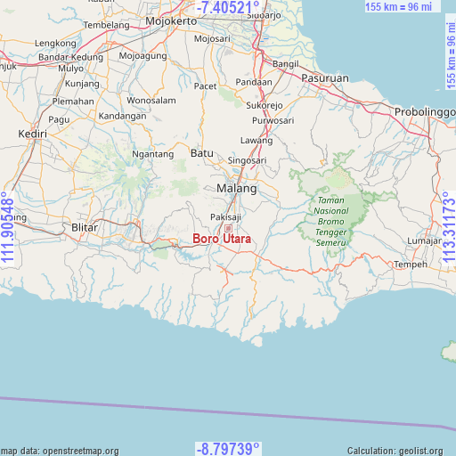
Boro Utara GPS coordinates[2]
8° 6' 6.84" South, 112° 36' 30.96" East
| Map corner | latitude | longitude |
|---|---|---|
| Upper-left | -7.40521°, | 111.90548° |
| Center: | -8.1019°, | 112.6086° |
| Lower-right: | -8.79739°, | 113.31173° |
| Map W x H: | 154.8×154.8 km | = 96.2×96.2mi |
| max Lat: | 5.88969° ⇑65.7% North |
| Boro Utara: | -8.1019° |
| min Lat: | ⇓34.3% South -10.934° |
| min Long | Boro Utara | max Long |
| 95.1345° | 112.6086° | 140.9419° |
| W 56.1%⇐ | ⇒43.9% E |
Elevation
Elevation of Boro Utara is 374 m = 1227 ft, and this is 144.3 m = 473 ft above average elevation for this country.
| Max E: |
3185 m = 10449 ft | 23.9% |
| Boro Utara | 374 m 1227 ft | |
| Avg. | 229.7 m = 754 ft | |
Min E: |
-1 m = -3 ft | 76.1% |
See also: Indonesia elevation on elevation.city.
Geographical zone
Boro Utara is located in South Torrid zone (between Equator and Tropic of Capricorn). Distance of Equator is 900.8 km =559.7 mi to North.| Distance of | km | miles | from Boro Utara |
|---|---|---|---|
| Equator | 900.8 | 559.7 | to North |
| Tropic Capricorn | 1705.1 | 1059.5 | to South |
| Antarctic Circle | 6500.3 | 4039.1 | to South |
| South Pole | 9106.2 | 5658.3 | to South |


Nearby cities:
15 places around Boro Utara: (largest is in red/bold)
• Bendo
3.7 km =2.3 mi,  331°
331°
• Blobo
2 km =1.2 mi,  220°
220°
• Bulupitukrajan
3.5 km =2.2 mi,  191°
191°
• Bureng
2.2 km =1.4 mi,  155°
155°
• Gading
2.9 km =1.8 mi,  91°
91°
• Glanggang
2.4 km =1.5 mi, 334°
• Golek
4.2 km =2.6 mi,  5°
5°
• Krapyak Kidul
4.3 km =2.7 mi,  78°
78°
• Krebet
3.3 km =2.1 mi, 75°
• Ngadilangkung
3.6 km =2.2 mi,  263°
263°
• Pakisaji
4.1 km =2.5 mi,  343°
343°
• Putukrejo
3.8 km =2.4 mi,  135°
135°
• Sidoaji
3.1 km =1.9 mi,  58°
58°
• Sukonolo Krajan
0.9 km =0.6 mi,  98°
98°
• Wonokerso
2.8 km =1.7 mi, 6°
Sources, notices
• [Note1] Compared only with cities in Indonesia existing in our database
• [Src1] Map data: © OpenStreetMap contributors (CC-BY-SA)
• [Src2] Other city data from geonames.org with taken over terms of usage.
• [Src3] Geographical zone / Annual Mean Temperature by Robert A. Rohde @ Wikipedia
