Rejanegara geodata
Rejanegara (Central Java) is a seat of a third-order administrative division; located in Indonesia in Asia/Jakarta (GMT+7) time zone. In our database, there are 407 cities with bigger population. Compared to other cities in Indonesia, 59.5% of cities are located further ↑North; 66.9% of cities are located further →East and 95.5% of cities have higher elevation than Rejanegara. Note1


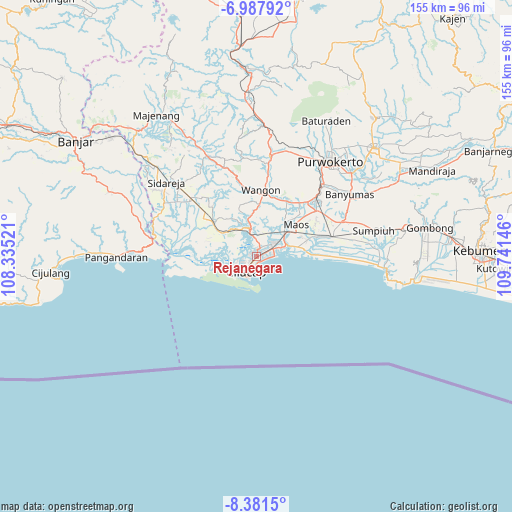
Rejanegara GPS coordinates[2]
7° 41' 7.008" South, 109° 2' 17.988" East
| Map corner | latitude | longitude |
|---|---|---|
| Upper-left | -6.98792°, | 108.33521° |
| Center: | -7.68528°, | 109.03833° |
| Lower-right: | -8.3815°, | 109.74146° |
| Map W x H: | 155×155 km | = 96.3×96.3mi |
| max Lat: | 5.88969° ⇑59.5% North |
| Rejanegara: | -7.68528° |
| min Lat: | ⇓40.5% South -10.934° |
| min Long | Rejanegara | max Long |
| 95.1345° | 109.03833° | 140.9419° |
| W 33.1%⇐ | ⇒66.9% E |
Elevation
Elevation of Rejanegara is 7 m = 23 ft, and this is 222.7 m = 731 ft below average elevation for this country.
| Max E: |
3185 m = 10449 ft | 95.5% |
| Avg. | 229.7 m = 754 ft | |
| Rejanegara | 7 m = 23 ft | |
Min E: |
-1 m = -3 ft | 4.5% |
See also: Indonesia elevation on elevation.city.
Geographical zone
Rejanegara is located in South Torrid zone (between Equator and Tropic of Capricorn). Distance of Equator is 854.5 km =531 mi to North.| Distance of | km | miles | from Rejanegara |
|---|---|---|---|
| Equator | 854.5 | 531 | to North |
| Tropic Capricorn | 1751.4 | 1088.3 | to South |
| Antarctic Circle | 6546.7 | 4067.9 | to South |
| South Pole | 9152.5 | 5687.1 | to South |


Nearby cities:
15 places around Rejanegara: (largest is in red/bold)
• Adipala
12.6 km =7.8 mi,  76°
76°
• Bantarsari Kulon
11 km =6.8 mi,  32°
32°
• Cilacap
5.6 km =3.5 mi,  214°
214°
• Dawuhan
10.2 km =6.3 mi, 28°
• Jambuandap
13.2 km =8.2 mi,  354°
354°
• Jeruklegi
7.1 km =4.4 mi,  342°
342°
• Karangbadar Kidul
2.4 km =1.5 mi,  200°
200°
• Karangrena
13.2 km =8.2 mi,  48°
48°
• Keleng
12.9 km =8 mi,  38°
38°
• Kesugihan
11.9 km =7.4 mi, 50°
• Krikil
13.7 km =8.5 mi,  60°
60°
• Madusari
8.2 km =5.1 mi, 32°
• Mandala
9.9 km =6.2 mi,  11°
11°
• Sawoan
8.1 km =5 mi,  23°
23°
• Watuagung
13.2 km =8.2 mi, 39°
Sources, notices
• [Note1] Compared only with cities in Indonesia existing in our database
• [Src1] Map data: © OpenStreetMap contributors (CC-BY-SA)
• [Src2] Other city data from geonames.org with taken over terms of usage.
• [Src3] Geographical zone / Annual Mean Temperature by Robert A. Rohde @ Wikipedia
