Dempel geodata
Dempel (East Java) is a seat of a fourth-order administrative division; located in Indonesia in Asia/Jakarta (GMT+7) time zone. In our database, there are 407 cities with bigger population. Compared to other cities in Indonesia, 65.9% of cities are located further ↓South; 51% of cities are located further ←West and 66.4% of cities have higher elevation than Dempel. Note1


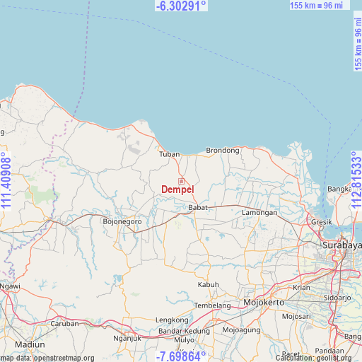
Dempel GPS coordinates[2]
7° 0' 4.68" South, 112° 6' 43.92" East
| Map corner | latitude | longitude |
|---|---|---|
| Upper-left | -6.30291°, | 111.40908° |
| Center: | -7.0013°, | 112.1122° |
| Lower-right: | -7.69864°, | 112.81533° |
| Map W x H: | 155.2×155.2 km | = 96.4×96.4mi |
| max Lat: | 5.88969° ⇑34.1% North |
| Dempel: | -7.0013° |
| min Lat: | ⇓65.9% South -10.934° |
| min Long | Dempel | max Long |
| 95.1345° | 112.1122° | 140.9419° |
| W 51%⇐ | ⇒49% E |
Elevation
Elevation of Dempel is 39 m = 128 ft, and this is 190.7 m = 626 ft below average elevation for this country.
| Max E: |
3185 m = 10449 ft | 66.4% |
| Avg. | 229.7 m = 754 ft | |
| Dempel | 39 m = 128 ft | |
Min E: |
-1 m = -3 ft | 33.6% |
See also: Indonesia elevation on elevation.city.
Geographical zone
Dempel is located in South Torrid zone (between Equator and Tropic of Capricorn). Distance of Equator is 778.5 km =483.7 mi to North.| Distance of | km | miles | from Dempel |
|---|---|---|---|
| Equator | 778.5 | 483.7 | to North |
| Tropic Capricorn | 1827.4 | 1135.5 | to South |
| Antarctic Circle | 6622.7 | 4115.2 | to South |
| South Pole | 9228.6 | 5734.4 | to South |


Nearby cities:
15 places around Dempel: (largest is in red/bold)
• Banjarsari
8.2 km =5.1 mi,  349°
349°
• Cendoro Utara
8.4 km =5.2 mi,  17°
17°
• Dawung
8 km =5 mi,  359°
359°
• Drudikrajan
6.1 km =3.8 mi,  296°
296°
• Gesing
4.1 km =2.5 mi, 355°
• Kebondempet
6.9 km =4.3 mi, 349°
• Kowang Utara
7 km =4.3 mi,  335°
335°
• Krajan Dermawuharjo
9.1 km =5.7 mi,  266°
266°
• Krajan Genaharjo
6.2 km =3.9 mi,  312°
312°
• Mlangi
7.9 km =4.9 mi,  87°
87°
• Ngimbang
5.5 km =3.4 mi,  39°
39°
• Nginokrajan
5.3 km =3.3 mi,  279°
279°
• Penambangan
9 km =5.6 mi,  321°
321°
• Pucangkrajan
9.4 km =5.8 mi, 19°
• Sumberjo
6 km =3.7 mi, 86°
Sources, notices
• [Note1] Compared only with cities in Indonesia existing in our database
• [Src1] Map data: © OpenStreetMap contributors (CC-BY-SA)
• [Src2] Other city data from geonames.org with taken over terms of usage.
• [Src3] Geographical zone / Annual Mean Temperature by Robert A. Rohde @ Wikipedia
