Ampelgading geodata
Ampelgading (East Java) is a seat of a fourth-order administrative division; located in Indonesia in Asia/Jakarta (GMT+7) time zone. In our database, there are 407 cities with bigger population. Compared to other cities in Indonesia, 63.2% of cities are located further ↑North; 54.1% of cities are located further ←West and 91.3% of cities have lower elevation than Ampelgading. Note1


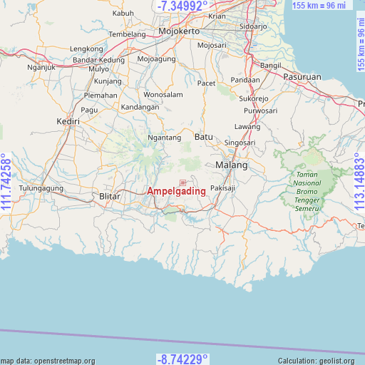
Ampelgading GPS coordinates[2]
8° 2' 48.12" South, 112° 26' 44.52" East
| Map corner | latitude | longitude |
|---|---|---|
| Upper-left | -7.34992°, | 111.74258° |
| Center: | -8.0467°, | 112.4457° |
| Lower-right: | -8.74229°, | 113.14883° |
| Map W x H: | 154.8×154.8 km | = 96.2×96.2mi |
| max Lat: | 5.88969° ⇑63.2% North |
| Ampelgading: | -8.0467° |
| min Lat: | ⇓36.8% South -10.934° |
| min Long | Ampelgading | max Long |
| 95.1345° | 112.4457° | 140.9419° |
| W 54.1%⇐ | ⇒45.9% E |
Elevation
Elevation of Ampelgading is 686 m = 2251 ft, and this is 456.3 m = 1497 ft above average elevation for this country.
| Max E: |
3185 m = 10449 ft | 8.7% |
| Ampelgading | 686 m 2251 ft | |
| Avg. | 229.7 m = 754 ft | |
Min E: |
-1 m = -3 ft | 91.3% |
See also: Indonesia elevation on elevation.city.
Geographical zone
Ampelgading is located in South Torrid zone (between Equator and Tropic of Capricorn). Distance of Equator is 894.7 km =555.9 mi to North.| Distance of | km | miles | from Ampelgading |
|---|---|---|---|
| Equator | 894.7 | 555.9 | to North |
| Tropic Capricorn | 1711.2 | 1063.3 | to South |
| Antarctic Circle | 6506.5 | 4043 | to South |
| South Pole | 9112.4 | 5662.2 | to South |


Nearby cities:
15 places around Ampelgading: (largest is in red/bold)
• Balerejo
7.8 km =4.8 mi,  283°
283°
• Bumirejo
2.4 km =1.5 mi,  234°
234°
• Cungkup
5.6 km =3.5 mi,  202°
202°
• Jambuwerkrajan
5.5 km =3.4 mi,  159°
159°
• Jarangan
6.8 km =4.2 mi,  179°
179°
• Kalimanis
0.9 km =0.6 mi, 281°
• Kemiri Gede
5.1 km =3.2 mi, 230°
• Kepel
7.9 km =4.9 mi,  193°
193°
• Kertorejo
7.4 km =4.6 mi, 157°
• Resapombo
3 km =1.9 mi,  274°
274°
• Ringinrejo
7.6 km =4.7 mi,  237°
237°
• Sidomulyo
5.1 km =3.2 mi, 175°
• Sumberingin
2.2 km =1.4 mi,  78°
78°
• Tempursari Wetan
4.8 km =3 mi,  97°
97°
• Wonosari
5.7 km =3.5 mi,  68°
68°
Sources, notices
• [Note1] Compared only with cities in Indonesia existing in our database
• [Src1] Map data: © OpenStreetMap contributors (CC-BY-SA)
• [Src2] Other city data from geonames.org with taken over terms of usage.
• [Src3] Geographical zone / Annual Mean Temperature by Robert A. Rohde @ Wikipedia
