Sekaran geodata
Sekaran (East Java) is a seat of a fourth-order administrative division; located in Indonesia in Asia/Jakarta (GMT+7) time zone. In our database, there are 407 cities with bigger population. Compared to other cities in Indonesia, 58.8% of cities are located further ↓South; 55.4% of cities are located further →East and 68.4% of cities have higher elevation than Sekaran. Note1


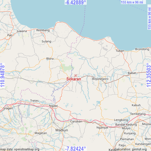
Sekaran GPS coordinates[2]
7° 7' 37.56" South, 111° 39' 6.84" East
| Map corner | latitude | longitude |
|---|---|---|
| Upper-left | -6.42889°, | 110.94878° |
| Center: | -7.1271°, | 111.6519° |
| Lower-right: | -7.82424°, | 112.35503° |
| Map W x H: | 155.1×155.2 km | = 96.4×96.4mi |
| max Lat: | 5.88969° ⇑41.2% North |
| Sekaran: | -7.1271° |
| min Lat: | ⇓58.8% South -10.934° |
| min Long | Sekaran | max Long |
| 95.1345° | 111.6519° | 140.9419° |
| W 44.6%⇐ | ⇒55.4% E |
Elevation
Elevation of Sekaran is 35 m = 115 ft, and this is 194.7 m = 639 ft below average elevation for this country.
| Max E: |
3185 m = 10449 ft | 68.4% |
| Avg. | 229.7 m = 754 ft | |
| Sekaran | 35 m = 115 ft | |
Min E: |
-1 m = -3 ft | 31.6% |
See also: Indonesia elevation on elevation.city.
Geographical zone
Sekaran is located in South Torrid zone (between Equator and Tropic of Capricorn). Distance of Equator is 792.5 km =492.4 mi to North.| Distance of | km | miles | from Sekaran |
|---|---|---|---|
| Equator | 792.5 | 492.4 | to North |
| Tropic Capricorn | 1813.5 | 1126.9 | to South |
| Antarctic Circle | 6608.7 | 4106.5 | to South |
| South Pole | 9214.6 | 5725.7 | to South |


Nearby cities:
15 places around Sekaran: (largest is in red/bold)
• Banjarjo
4.4 km =2.7 mi,  217°
217°
• Batokan
4.7 km =2.9 mi,  247°
247°
• Besah
1.7 km =1.1 mi,  234°
234°
• Bulu
5 km =3.1 mi,  149°
149°
• Caper
4.5 km =2.8 mi,  258°
258°
• Dukuh Lor
4.1 km =2.5 mi,  167°
167°
• Kacangan Lor
2.8 km =1.7 mi,  141°
141°
• Kembangan
4.8 km =3 mi,  118°
118°
• Kuncen
4.7 km =2.9 mi, 225°
• Padangan
5.1 km =3.2 mi, 234°
• Purwosari
5.1 km =3.2 mi, 171°
• Semanding
4.2 km =2.6 mi, 116°
• Suroh
1.2 km =0.7 mi,  127°
127°
• Tambakmerak
1.8 km =1.1 mi,  45°
45°
• Tembeling
4.1 km =2.5 mi,  181°
181°
Sources, notices
• [Note1] Compared only with cities in Indonesia existing in our database
• [Src1] Map data: © OpenStreetMap contributors (CC-BY-SA)
• [Src2] Other city data from geonames.org with taken over terms of usage.
• [Src3] Geographical zone / Annual Mean Temperature by Robert A. Rohde @ Wikipedia
