Mojosawit geodata
Mojosawit (East Java) is a seat of a fourth-order administrative division; located in Indonesia in Asia/Jakarta (GMT+7) time zone. In our database, there are 407 cities with bigger population. Compared to other cities in Indonesia, 53.2% of cities are located further ↓South; 54.2% of cities are located further →East and 61.1% of cities have higher elevation than Mojosawit. Note1


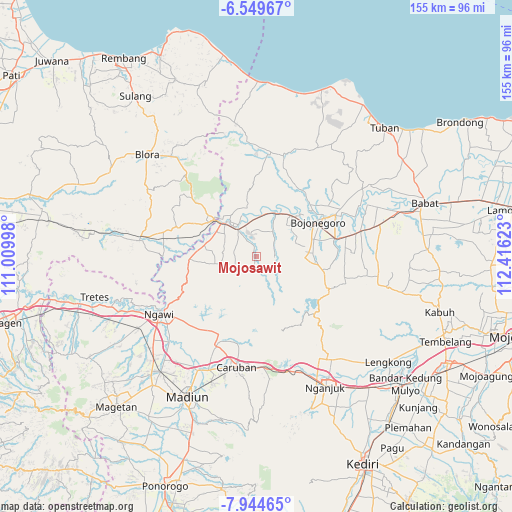
Mojosawit GPS coordinates[2]
7° 14' 51.72" South, 111° 42' 47.16" East
| Map corner | latitude | longitude |
|---|---|---|
| Upper-left | -6.54967°, | 111.00998° |
| Center: | -7.2477°, | 111.7131° |
| Lower-right: | -7.94465°, | 112.41623° |
| Map W x H: | 155.1×155.1 km | = 96.4×96.4mi |
| max Lat: | 5.88969° ⇑46.8% North |
| Mojosawit: | -7.2477° |
| min Lat: | ⇓53.2% South -10.934° |
| min Long | Mojosawit | max Long |
| 95.1345° | 111.7131° | 140.9419° |
| W 45.8%⇐ | ⇒54.2% E |
Elevation
Elevation of Mojosawit is 55 m = 180 ft, and this is 174.7 m = 573 ft below average elevation for this country.
| Max E: |
3185 m = 10449 ft | 61.1% |
| Avg. | 229.7 m = 754 ft | |
| Mojosawit | 55 m = 180 ft | |
Min E: |
-1 m = -3 ft | 38.9% |
See also: Indonesia elevation on elevation.city.
Geographical zone
Mojosawit is located in South Torrid zone (between Equator and Tropic of Capricorn). Distance of Equator is 805.9 km =500.8 mi to North.| Distance of | km | miles | from Mojosawit |
|---|---|---|---|
| Equator | 805.9 | 500.8 | to North |
| Tropic Capricorn | 1800.1 | 1118.5 | to South |
| Antarctic Circle | 6595.3 | 4098.1 | to South |
| South Pole | 9201.2 | 5717.4 | to South |


Nearby cities:
15 places around Mojosawit: (largest is in red/bold)
• Beged
9.5 km =5.9 mi,  329°
329°
• Bonorejo
8.1 km =5 mi, 332°
• Bulu
10 km =6.2 mi,  335°
335°
• Dawung
5.7 km =3.5 mi, 336°
• Donan
9.5 km =5.9 mi,  298°
298°
• Dukuh Lor
11.1 km =6.9 mi, 328°
• Gapluk
7.4 km =4.6 mi,  310°
310°
• Gayam
7.9 km =4.9 mi,  0°
0°
• Katur
9.9 km =6.2 mi, 3°
• Ngrejeng
3.4 km =2.1 mi,  349°
349°
• Pelem
1.1 km =0.7 mi,  316°
316°
• Purwosari
10.3 km =6.4 mi, 324°
• Ringintunggal
8.6 km =5.3 mi,  359°
359°
• Tinumpuk
5 km =3.1 mi, 322°
• Tlatah
4.2 km =2.6 mi, 341°
Sources, notices
• [Note1] Compared only with cities in Indonesia existing in our database
• [Src1] Map data: © OpenStreetMap contributors (CC-BY-SA)
• [Src2] Other city data from geonames.org with taken over terms of usage.
• [Src3] Geographical zone / Annual Mean Temperature by Robert A. Rohde @ Wikipedia
