Dajanrurung geodata
Dajanrurung (Bali) is a seat of a fourth-order administrative division; located in Indonesia in Asia/Makassar (GMT+8) time zone. In our database, there are 407 cities with bigger population. Compared to other cities in Indonesia, 71.6% of cities are located further ↑North; 70.3% of cities are located further ←West and 71.9% of cities have higher elevation than Dajanrurung. Note1


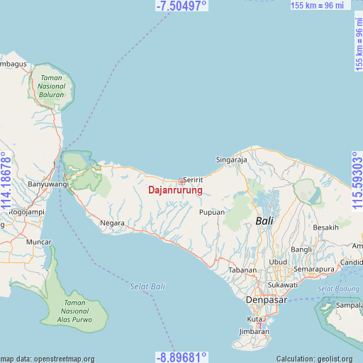
Dajanrurung GPS coordinates[2]
8° 12' 5.4" South, 114° 53' 23.64" East
| Map corner | latitude | longitude |
|---|---|---|
| Upper-left | -7.50497°, | 114.18678° |
| Center: | -8.2015°, | 114.8899° |
| Lower-right: | -8.89681°, | 115.59303° |
| Map W x H: | 154.8×154.8 km | = 96.2×96.2mi |
| max Lat: | 5.88969° ⇑71.6% North |
| Dajanrurung: | -8.2015° |
| min Lat: | ⇓28.4% South -10.934° |
| min Long | Dajanrurung | max Long |
| 95.1345° | 114.8899° | 140.9419° |
| W 70.3%⇐ | ⇒29.7% E |
Elevation
Elevation of Dajanrurung is 29 m = 95 ft, and this is 200.7 m = 658 ft below average elevation for this country.
| Max E: |
3185 m = 10449 ft | 71.9% |
| Avg. | 229.7 m = 754 ft | |
| Dajanrurung | 29 m = 95 ft | |
Min E: |
-1 m = -3 ft | 28.1% |
See also: Indonesia elevation on elevation.city.
Geographical zone
Dajanrurung is located in South Torrid zone (between Equator and Tropic of Capricorn). Distance of Equator is 911.9 km =566.6 mi to North.| Distance of | km | miles | from Dajanrurung |
|---|---|---|---|
| Equator | 911.9 | 566.6 | to North |
| Tropic Capricorn | 1694 | 1052.6 | to South |
| Antarctic Circle | 6489.3 | 4032.3 | to South |
| South Pole | 9095.1 | 5651.4 | to South |


Nearby cities:
15 places around Dajanrurung: (largest is in red/bold)
• Ambian
8.7 km =5.4 mi,  88°
88°
• Baleagung
7 km =4.3 mi,  139°
139°
• Banjar
8.6 km =5.3 mi,  81°
81°
• Banjar Dawan
7.6 km =4.7 mi, 88°
• Kajanan
6 km =3.7 mi,  110°
110°
• Kelodan
7 km =4.3 mi, 91°
• Kertanadi
7.6 km =4.7 mi,  118°
118°
• Lebahseri
7 km =4.3 mi, 140°
• Pangkungparuk
1.5 km =0.9 mi,  192°
192°
• Purwa
4.6 km =2.9 mi,  70°
70°
• Seririt
5.5 km =3.4 mi, 79°
• Tamansari
6 km =3.7 mi, 84°
• Tangguwisia
6.3 km =3.9 mi, 86°
• Umbanyar
3.2 km =2 mi, 76°
• Yatnyaketi
5.9 km =3.7 mi,  131°
131°
Sources, notices
• [Note1] Compared only with cities in Indonesia existing in our database
• [Src1] Map data: © OpenStreetMap contributors (CC-BY-SA)
• [Src2] Other city data from geonames.org with taken over terms of usage.
• [Src3] Geographical zone / Annual Mean Temperature by Robert A. Rohde @ Wikipedia
