Pengembur Dua geodata
Pengembur Dua (West Nusa Tenggara) is a seat of a fourth-order administrative division; located in Indonesia in Asia/Makassar (GMT+8) time zone. In our database, there are 407 cities with bigger population. Compared to other cities in Indonesia, 91.5% of cities are located further ↑North; 76.5% of cities are located further ←West and 53% of cities have higher elevation than Pengembur Dua. Note1


Pengembur Dua GPS coordinates[2]
8° 48' 26.28" South, 116° 15' 45.36" East
| Map corner | latitude | longitude |
|---|---|---|
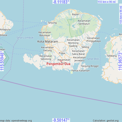
| Upper-left | -8.11183°, | 115.55948° |
| Center: | -8.8073°, | 116.2626° |
| Lower-right: | -9.50147°, | 116.96573° |
| Map W x H: | 154.5×154.5 km | = 96×96mi |
| max Lat: | 5.88969° ⇑91.5% North |
| Pengembur Dua: | -8.8073° |
| min Lat: | ⇓8.5% South -10.934° |
| min Long | Pengembur Dua | max Long |
| 95.1345° | 116.2626° | 140.9419° |
| W 76.5%⇐ | ⇒23.5% E |
Elevation
Elevation of Pengembur Dua is 92 m = 302 ft, and this is 137.7 m = 452 ft below average elevation for this country.
| Max E: |
3185 m = 10449 ft | 53% |
| Avg. | 229.7 m = 754 ft | |
| Pengembur Dua | 92 m = 302 ft | |
Min E: |
-1 m = -3 ft | 47% |
See also: Indonesia elevation on elevation.city.
Geographical zone
Pengembur Dua is located in South Torrid zone (between Equator and Tropic of Capricorn). Distance of Equator is 979.3 km =608.5 mi to North.| Distance of | km | miles | from Pengembur Dua |
|---|---|---|---|
| Equator | 979.3 | 608.5 | to North |
| Tropic Capricorn | 1626.6 | 1010.7 | to South |
| Antarctic Circle | 6421.9 | 3990.4 | to South |
| South Pole | 9027.8 | 5609.6 | to South |


Nearby cities:
15 places around Pengembur Dua: (largest is in red/bold)
• Bagiktinggang
8 km =5 mi,  34°
34°
• Bangekdewa
10.2 km =6.3 mi,  310°
310°
• Karang Daye
7.3 km =4.5 mi,  341°
341°
• Karangdalam
8 km =5 mi, 344°
• Ketara
2.8 km =1.7 mi,  44°
44°
• Kute
9.6 km =6 mi,  170°
170°
• Majan
10.2 km =6.3 mi, 32°
• Mujur
11.3 km =7 mi,  63°
63°
• Penunjak
7.3 km =4.5 mi, 340°
• Permas
9.8 km =6.1 mi,  322°
322°
• Rangah
10.1 km =6.3 mi,  73°
73°
• Semayan
10.1 km =6.3 mi,  13°
13°
• Tamanbumigora
6.1 km =3.8 mi,  53°
53°
• Tanakawu Dua
3.7 km =2.3 mi, 8°
• Teruwai
8.2 km =5.1 mi,  93°
93°
Sources, notices
• [Note1] Compared only with cities in Indonesia existing in our database
• [Src1] Map data: © OpenStreetMap contributors (CC-BY-SA)
• [Src2] Other city data from geonames.org with taken over terms of usage.
• [Src3] Geographical zone / Annual Mean Temperature by Robert A. Rohde @ Wikipedia
