Lokuuy geodata
Lokuuy (East Nusa Tenggara) is a seat of a fourth-order administrative division; located in Indonesia in Asia/Makassar (GMT+8) time zone. In our database, there are 407 cities with bigger population. Compared to other cities in Indonesia, 93.5% of cities are located further ↑North; 82.3% of cities are located further ←West and 77.4% of cities have lower elevation than Lokuuy. Note1


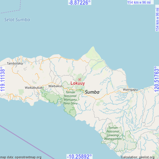
Lokuuy GPS coordinates[2]
9° 33' 58.68" South, 119° 48' 52.2" East
| Map corner | latitude | longitude |
|---|---|---|
| Upper-left | -8.87226°, | 119.11138° |
| Center: | -9.5663°, | 119.8145° |
| Lower-right: | -10.25892°, | 120.51763° |
| Map W x H: | 154.2×154.2 km | = 95.8×95.8mi |
| max Lat: | 5.88969° ⇑93.5% North |
| Lokuuy: | -9.5663° |
| min Lat: | ⇓6.5% South -10.934° |
| min Long | Lokuuy | max Long |
| 95.1345° | 119.8145° | 140.9419° |
| W 82.3%⇐ | ⇒17.7% E |
Elevation
Elevation of Lokuuy is 391 m = 1283 ft, and this is 161.3 m = 529 ft above average elevation for this country.
| Max E: |
3185 m = 10449 ft | 22.6% |
| Lokuuy | 391 m 1283 ft | |
| Avg. | 229.7 m = 754 ft | |
Min E: |
-1 m = -3 ft | 77.4% |
See also: Indonesia elevation on elevation.city.
Geographical zone
Lokuuy is located in South Torrid zone (between Equator and Tropic of Capricorn). Distance of Equator is 1063.7 km =661 mi to North.| Distance of | km | miles | from Lokuuy |
|---|---|---|---|
| Equator | 1063.7 | 661 | to North |
| Tropic Capricorn | 1542.2 | 958.3 | to South |
| Antarctic Circle | 6337.5 | 3937.9 | to South |
| South Pole | 8943.4 | 5557.2 | to South |


Nearby cities:
15 places around Lokuuy: (largest is in red/bold)
• Alanga
7.4 km =4.6 mi,  294°
294°
• Bolubewa
11.7 km =7.3 mi, 288°
• Kambatatamakawu
18.3 km =11.4 mi,  28°
28°
• Lawonda
24.8 km =15.4 mi,  280°
280°
• Manukaka
25.1 km =15.6 mi,  262°
262°
• Matumadua
20.8 km =12.9 mi,  341°
341°
• Napu
22.5 km =14 mi, 32°
• Ngarangiakambera
23.9 km =14.9 mi,  119°
119°
• Pahomba
6.6 km =4.1 mi,  194°
194°
• Prailangina
11.9 km =7.4 mi,  219°
219°
• Pretana
19.5 km =12.1 mi,  253°
253°
• Tamanaimahu
24.7 km =15.3 mi, 251°
• Waihibar
21.5 km =13.4 mi, 256°
• Waikambila
16.4 km =10.2 mi, 283°
• Wailolung
25.6 km =15.9 mi, 264°
Sources, notices
• [Note1] Compared only with cities in Indonesia existing in our database
• [Src1] Map data: © OpenStreetMap contributors (CC-BY-SA)
• [Src2] Other city data from geonames.org with taken over terms of usage.
• [Src3] Geographical zone / Annual Mean Temperature by Robert A. Rohde @ Wikipedia
