Waihibar geodata
Waihibar (East Nusa Tenggara) is a seat of a fourth-order administrative division; located in Indonesia in Asia/Makassar (GMT+8) time zone. In our database, there are 407 cities with bigger population. Compared to other cities in Indonesia, 93.9% of cities are located further ↑North; 82.1% of cities are located further ←West and 81.1% of cities have lower elevation than Waihibar. Note1


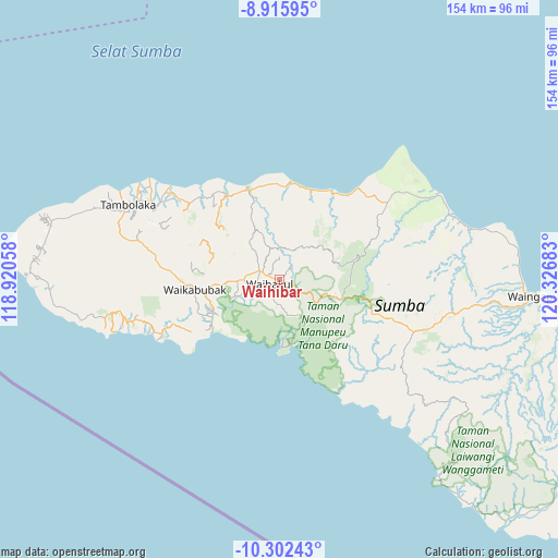
Waihibar GPS coordinates[2]
9° 36' 35.64" South, 119° 37' 25.32" East
| Map corner | latitude | longitude |
|---|---|---|
| Upper-left | -8.91595°, | 118.92058° |
| Center: | -9.6099°, | 119.6237° |
| Lower-right: | -10.30243°, | 120.32683° |
| Map W x H: | 154.2×154.2 km | = 95.8×95.8mi |
| max Lat: | 5.88969° ⇑93.9% North |
| Waihibar: | -9.6099° |
| min Lat: | ⇓6.1% South -10.934° |
| min Long | Waihibar | max Long |
| 95.1345° | 119.6237° | 140.9419° |
| W 82.1%⇐ | ⇒17.9% E |
Elevation
Elevation of Waihibar is 449 m = 1473 ft, and this is 219.3 m = 719 ft above average elevation for this country.
| Max E: |
3185 m = 10449 ft | 18.9% |
| Waihibar | 449 m 1473 ft | |
| Avg. | 229.7 m = 754 ft | |
Min E: |
-1 m = -3 ft | 81.1% |
See also: Indonesia elevation on elevation.city.
Geographical zone
Waihibar is located in South Torrid zone (between Equator and Tropic of Capricorn). Distance of Equator is 1068.5 km =663.9 mi to North.| Distance of | km | miles | from Waihibar |
|---|---|---|---|
| Equator | 1068.5 | 663.9 | to North |
| Tropic Capricorn | 1537.4 | 955.3 | to South |
| Antarctic Circle | 6332.7 | 3935 | to South |
| South Pole | 8938.5 | 5554.1 | to South |


Nearby cities:
15 places around Waihibar: (largest is in red/bold)
• Alanga
16.2 km =10.1 mi,  60°
60°
• Bolubewa
13 km =8.1 mi,  49°
49°
• Galubakul
6.4 km =4 mi,  259°
259°
• Kabondok
5.8 km =3.6 mi,  281°
281°
• Katikuloko
9 km =5.6 mi, 278°
• Lawonda
10 km =6.2 mi,  339°
339°
• Manukaka
4.2 km =2.6 mi,  289°
289°
• Prailangina
14 km =8.7 mi,  107°
107°
• Pretana
2.3 km =1.4 mi, 107°
• Tamaau
7.8 km =4.8 mi, 286°
• Tamanaimahu
4 km =2.5 mi,  218°
218°
• Tanarara
9.1 km =5.7 mi,  253°
253°
• Tanatoku
13.5 km =8.4 mi,  316°
316°
• Waikambila
9.9 km =6.2 mi,  29°
29°
• Wailolung
5.2 km =3.2 mi,  298°
298°
Sources, notices
• [Note1] Compared only with cities in Indonesia existing in our database
• [Src1] Map data: © OpenStreetMap contributors (CC-BY-SA)
• [Src2] Other city data from geonames.org with taken over terms of usage.
• [Src3] Geographical zone / Annual Mean Temperature by Robert A. Rohde @ Wikipedia
