Alanga geodata
Alanga (East Nusa Tenggara) is a seat of a fourth-order administrative division; located in Indonesia in Asia/Makassar (GMT+8) time zone. In our database, there are 407 cities with bigger population. Compared to other cities in Indonesia, 93.2% of cities are located further ↑North; 82.2% of cities are located further ←West and 79.9% of cities have lower elevation than Alanga. Note1


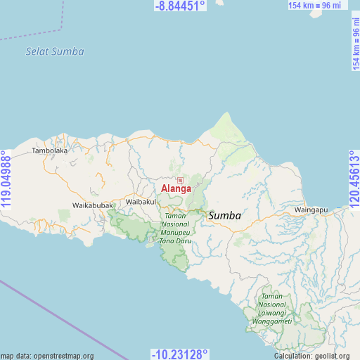
Alanga GPS coordinates[2]
9° 32' 18.96" South, 119° 45' 10.8" East
| Map corner | latitude | longitude |
|---|---|---|
| Upper-left | -8.84451°, | 119.04988° |
| Center: | -9.5386°, | 119.753° |
| Lower-right: | -10.23128°, | 120.45613° |
| Map W x H: | 154.2×154.2 km | = 95.8×95.8mi |
| max Lat: | 5.88969° ⇑93.2% North |
| Alanga: | -9.5386° |
| min Lat: | ⇓6.8% South -10.934° |
| min Long | Alanga | max Long |
| 95.1345° | 119.753° | 140.9419° |
| W 82.2%⇐ | ⇒17.8% E |
Elevation
Elevation of Alanga is 431 m = 1414 ft, and this is 201.3 m = 660 ft above average elevation for this country.
| Max E: |
3185 m = 10449 ft | 20.1% |
| Alanga | 431 m 1414 ft | |
| Avg. | 229.7 m = 754 ft | |
Min E: |
-1 m = -3 ft | 79.9% |
See also: Indonesia elevation on elevation.city.
Geographical zone
Alanga is located in South Torrid zone (between Equator and Tropic of Capricorn). Distance of Equator is 1060.6 km =659 mi to North.| Distance of | km | miles | from Alanga |
|---|---|---|---|
| Equator | 1060.6 | 659 | to North |
| Tropic Capricorn | 1545.3 | 960.2 | to South |
| Antarctic Circle | 6340.6 | 3939.9 | to South |
| South Pole | 8946.5 | 5559.1 | to South |


Nearby cities:
15 places around Alanga: (largest is in red/bold)
• Bolubewa
4.4 km =2.7 mi,  278°
278°
• Galubakul
22.4 km =13.9 mi,  245°
245°
• Kabondok
21 km =13 mi, 251°
• Kambatatamakawu
20.2 km =12.6 mi,  49°
49°
• Lawonda
17.7 km =11 mi,  274°
274°
• Lokuuy
7.4 km =4.6 mi,  114°
114°
• Manukaka
19.3 km =12 mi, 250°
• Matumadua
16.6 km =10.3 mi,  0°
0°
• Pahomba
10.8 km =6.7 mi,  151°
151°
• Prailangina
12.3 km =7.6 mi,  183°
183°
• Pretana
14.7 km =9.1 mi,  234°
234°
• Tamanaimahu
20 km =12.4 mi,  236°
236°
• Waihibar
16.2 km =10.1 mi, 240°
• Waikambila
9.2 km =5.7 mi, 274°
• Wailolung
19.6 km =12.2 mi, 253°
Sources, notices
• [Note1] Compared only with cities in Indonesia existing in our database
• [Src1] Map data: © OpenStreetMap contributors (CC-BY-SA)
• [Src2] Other city data from geonames.org with taken over terms of usage.
• [Src3] Geographical zone / Annual Mean Temperature by Robert A. Rohde @ Wikipedia
