Wongaya Kaja geodata
Wongaya Kaja (Bali) is a seat of a fourth-order administrative division; located in Indonesia in Asia/Makassar (GMT+8) time zone. In our database, there are 407 cities with bigger population. Compared to other cities in Indonesia, 80.1% of cities are located further ↑North; 71.7% of cities are located further ←West and 90.4% of cities have lower elevation than Wongaya Kaja. Note1


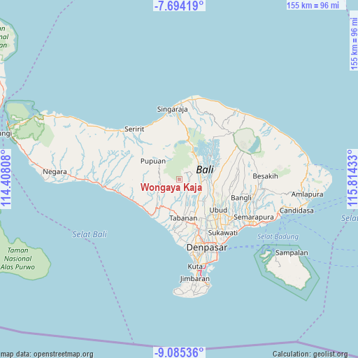
Wongaya Kaja GPS coordinates[2]
8° 23' 25.44" South, 115° 6' 40.32" East
| Map corner | latitude | longitude |
|---|---|---|
| Upper-left | -7.69419°, | 114.40808° |
| Center: | -8.3904°, | 115.1112° |
| Lower-right: | -9.08536°, | 115.81433° |
| Map W x H: | 154.7×154.7 km | = 96.1×96.1mi |
| max Lat: | 5.88969° ⇑80.1% North |
| Wongaya Kaja: | -8.3904° |
| min Lat: | ⇓19.9% South -10.934° |
| min Long | Wongaya Kaja | max Long |
| 95.1345° | 115.1112° | 140.9419° |
| W 71.7%⇐ | ⇒28.3% E |
Elevation
Elevation of Wongaya Kaja is 654 m = 2146 ft, and this is 424.3 m = 1392 ft above average elevation for this country.
| Max E: |
3185 m = 10449 ft | 9.6% |
| Wongaya Kaja | 654 m 2146 ft | |
| Avg. | 229.7 m = 754 ft | |
Min E: |
-1 m = -3 ft | 90.4% |
See also: Indonesia elevation on elevation.city.
Geographical zone
Wongaya Kaja is located in South Torrid zone (between Equator and Tropic of Capricorn). Distance of Equator is 932.9 km =579.7 mi to North.| Distance of | km | miles | from Wongaya Kaja |
|---|---|---|---|
| Equator | 932.9 | 579.7 | to North |
| Tropic Capricorn | 1673 | 1039.6 | to South |
| Antarctic Circle | 6468.2 | 4019.2 | to South |
| South Pole | 9074.1 | 5638.4 | to South |


Nearby cities:
15 places around Wongaya Kaja: (largest is in red/bold)
• Baleagung
7.3 km =4.5 mi,  161°
161°
• Banjar Angseri
6.8 km =4.2 mi,  57°
57°
• Banjar Apuan
7.7 km =4.8 mi,  72°
72°
• Banjar Senganan Kangin
6 km =3.7 mi, 66°
• Beaung Tengah
6.5 km =4 mi,  122°
122°
• Dalangdesa
6.5 km =4 mi,  211°
211°
• Denuma
3 km =1.9 mi, 156°
• Empalan
4.4 km =2.7 mi,  96°
96°
• Penatahan Kaja
5.3 km =3.3 mi, 162°
• Penebel
5 km =3.1 mi,  131°
131°
• Pohgending Kangin
5.9 km =3.7 mi,  140°
140°
• Pohgending Kawan
6.1 km =3.8 mi,  145°
145°
• Rejasa Kaja
7.9 km =4.9 mi,  175°
175°
• Tua
8 km =5 mi,  107°
107°
• Wanagiri
6.5 km =4 mi,  250°
250°
Sources, notices
• [Note1] Compared only with cities in Indonesia existing in our database
• [Src1] Map data: © OpenStreetMap contributors (CC-BY-SA)
• [Src2] Other city data from geonames.org with taken over terms of usage.
• [Src3] Geographical zone / Annual Mean Temperature by Robert A. Rohde @ Wikipedia
