Tua geodata
Tua (Bali) is a seat of a fourth-order administrative division; located in Indonesia in Asia/Makassar (GMT+8) time zone. In our database, there are 407 cities with bigger population. Compared to other cities in Indonesia, 80.7% of cities are located further ↑North; 72.4% of cities are located further ←West and 81.3% of cities have lower elevation than Tua. Note1


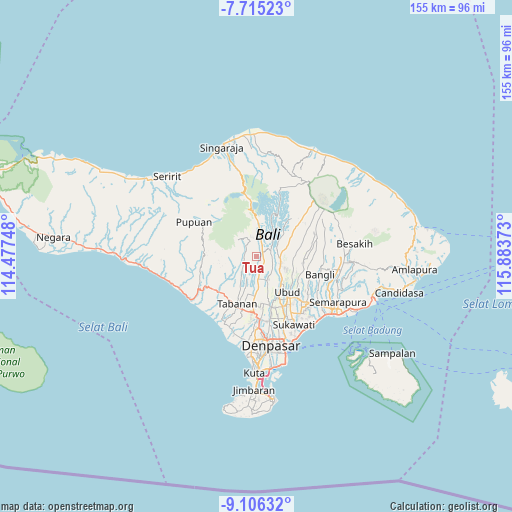
Tua GPS coordinates[2]
8° 24' 41.04" South, 115° 10' 50.16" East
| Map corner | latitude | longitude |
|---|---|---|
| Upper-left | -7.71523°, | 114.47748° |
| Center: | -8.4114°, | 115.1806° |
| Lower-right: | -9.10632°, | 115.88373° |
| Map W x H: | 154.7×154.7 km | = 96.1×96.1mi |
| max Lat: | 5.88969° ⇑80.7% North |
| Tua: | -8.4114° |
| min Lat: | ⇓19.3% South -10.934° |
| min Long | Tua | max Long |
| 95.1345° | 115.1806° | 140.9419° |
| W 72.4%⇐ | ⇒27.6% E |
Elevation
Elevation of Tua is 452 m = 1483 ft, and this is 222.3 m = 729 ft above average elevation for this country.
| Max E: |
3185 m = 10449 ft | 18.7% |
| Tua | 452 m 1483 ft | |
| Avg. | 229.7 m = 754 ft | |
Min E: |
-1 m = -3 ft | 81.3% |
See also: Indonesia elevation on elevation.city.
Geographical zone
Tua is located in South Torrid zone (between Equator and Tropic of Capricorn). Distance of Equator is 935.3 km =581.2 mi to North.| Distance of | km | miles | from Tua |
|---|---|---|---|
| Equator | 935.3 | 581.2 | to North |
| Tropic Capricorn | 1670.7 | 1038.1 | to South |
| Antarctic Circle | 6465.9 | 4017.7 | to South |
| South Pole | 9071.8 | 5637 | to South |


Nearby cities:
15 places around Tua: (largest is in red/bold)
• Banjar Apuan
4.7 km =2.9 mi,  356°
356°
• Banjar Senganan Kangin
5.2 km =3.2 mi,  335°
335°
• Beaung Tengah
2.4 km =1.5 mi,  242°
242°
• Empalan
3.7 km =2.3 mi,  299°
299°
• Luwus
2.2 km =1.4 mi,  48°
48°
• Pangsan
4.4 km =2.7 mi,  94°
94°
• Payangan Tengah
3.1 km =1.9 mi,  208°
208°
• Penebel
4 km =2.5 mi,  255°
255°
• Peneng
3.8 km =2.4 mi,  22°
22°
• Pergan
2.3 km =1.4 mi,  137°
137°
• Petang
4.5 km =2.8 mi,  68°
68°
• Petiga
2.7 km =1.7 mi,  187°
187°
• Pohgending Kangin
4.5 km =2.8 mi, 239°
• Pohgending Kawan
5 km =3.1 mi, 236°
• Tuka
3 km =1.9 mi, 140°
Sources, notices
• [Note1] Compared only with cities in Indonesia existing in our database
• [Src1] Map data: © OpenStreetMap contributors (CC-BY-SA)
• [Src2] Other city data from geonames.org with taken over terms of usage.
• [Src3] Geographical zone / Annual Mean Temperature by Robert A. Rohde @ Wikipedia
