Radamata geodata
Radamata (East Nusa Tenggara) is a seat of a fourth-order administrative division; located in Indonesia in Asia/Makassar (GMT+8) time zone. In our database, there are 407 cities with bigger population. Compared to other cities in Indonesia, 92.8% of cities are located further ↑North; 81.3% of cities are located further ←West and 57.2% of cities have higher elevation than Radamata. Note1


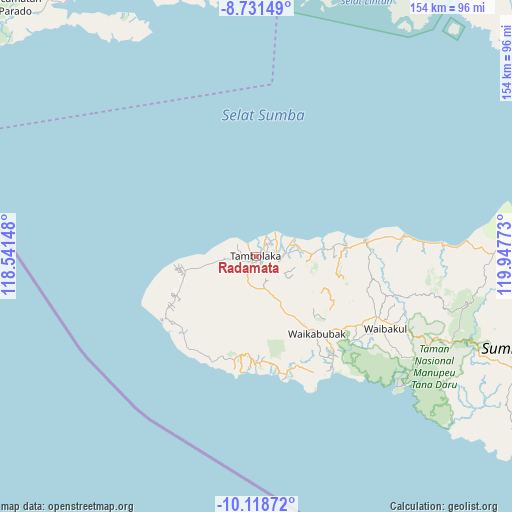
Radamata GPS coordinates[2]
9° 25' 32.88" South, 119° 14' 40.56" East
| Map corner | latitude | longitude |
|---|---|---|
| Upper-left | -8.73149°, | 118.54148° |
| Center: | -9.4258°, | 119.2446° |
| Lower-right: | -10.11872°, | 119.94773° |
| Map W x H: | 154.2×154.2 km | = 95.8×95.8mi |
| max Lat: | 5.88969° ⇑92.8% North |
| Radamata: | -9.4258° |
| min Lat: | ⇓7.2% South -10.934° |
| min Long | Radamata | max Long |
| 95.1345° | 119.2446° | 140.9419° |
| W 81.3%⇐ | ⇒18.7% E |
Elevation
Elevation of Radamata is 71 m = 233 ft, and this is 158.7 m = 521 ft below average elevation for this country.
| Max E: |
3185 m = 10449 ft | 57.2% |
| Avg. | 229.7 m = 754 ft | |
| Radamata | 71 m = 233 ft | |
Min E: |
-1 m = -3 ft | 42.8% |
See also: Indonesia elevation on elevation.city.
Geographical zone
Radamata is located in South Torrid zone (between Equator and Tropic of Capricorn). Distance of Equator is 1048.1 km =651.3 mi to North.| Distance of | km | miles | from Radamata |
|---|---|---|---|
| Equator | 1048.1 | 651.3 | to North |
| Tropic Capricorn | 1557.9 | 968 | to South |
| Antarctic Circle | 6353.1 | 3947.6 | to South |
| South Pole | 8959 | 5566.9 | to South |


Nearby cities:
15 places around Radamata: (largest is in red/bold)
• Andelara
15 km =9.3 mi,  150°
150°
• Bondoboghila
12 km =7.5 mi,  82°
82°
• Komi
6.4 km =4 mi,  94°
94°
• Maredakamau
6.4 km =4 mi,  260°
260°
• Marokota
11.2 km =7 mi,  221°
221°
• Ombakamia
12.5 km =7.8 mi, 148°
• Redakodi
3.7 km =2.3 mi,  211°
211°
• Tambolaka
0.8 km =0.5 mi,  248°
248°
• Totok
9.2 km =5.7 mi,  133°
133°
• Waimangura
9.4 km =5.8 mi,  184°
184°
• Watulabara
11.8 km =7.3 mi,  167°
167°
• Weekombaka
14.6 km =9.1 mi,  230°
230°
• Weepangali
2.1 km =1.3 mi, 92°
• Weerame
13.7 km =8.5 mi,  159°
159°
• Weetobula
2.2 km =1.4 mi, 218°
Sources, notices
• [Note1] Compared only with cities in Indonesia existing in our database
• [Src1] Map data: © OpenStreetMap contributors (CC-BY-SA)
• [Src2] Other city data from geonames.org with taken over terms of usage.
• [Src3] Geographical zone / Annual Mean Temperature by Robert A. Rohde @ Wikipedia
