Ngalupolo geodata
Ngalupolo (East Nusa Tenggara) is a seat of a fourth-order administrative division; located in Indonesia in Asia/Makassar (GMT+8) time zone. In our database, there are 407 cities with bigger population. Compared to other cities in Indonesia, 92.3% of cities are located further ↑North; 87.3% of cities are located further ←West and 68% of cities have higher elevation than Ngalupolo. Note1


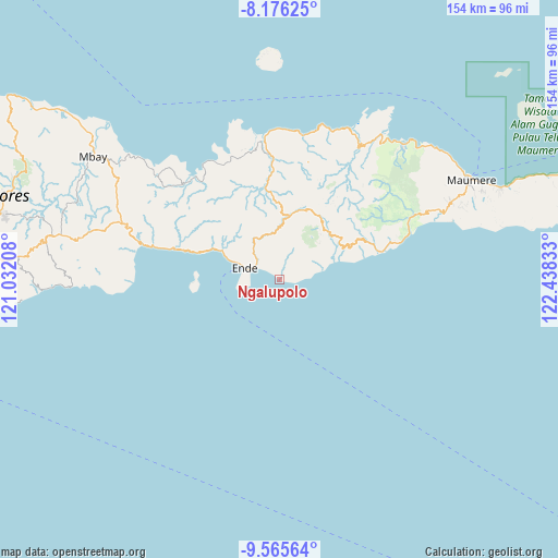
Ngalupolo GPS coordinates[2]
8° 52' 17.76" South, 121° 44' 6.72" East
| Map corner | latitude | longitude |
|---|---|---|
| Upper-left | -8.17625°, | 121.03208° |
| Center: | -8.8716°, | 121.7352° |
| Lower-right: | -9.56564°, | 122.43833° |
| Map W x H: | 154.5×154.5 km | = 96×96mi |
| max Lat: | 5.88969° ⇑92.3% North |
| Ngalupolo: | -8.8716° |
| min Lat: | ⇓7.7% South -10.934° |
| min Long | Ngalupolo | max Long |
| 95.1345° | 121.7352° | 140.9419° |
| W 87.3%⇐ | ⇒12.7% E |
Elevation
Elevation of Ngalupolo is 36 m = 118 ft, and this is 193.7 m = 635 ft below average elevation for this country.
| Max E: |
3185 m = 10449 ft | 68% |
| Avg. | 229.7 m = 754 ft | |
| Ngalupolo | 36 m = 118 ft | |
Min E: |
-1 m = -3 ft | 32% |
See also: Indonesia elevation on elevation.city.
Geographical zone
Ngalupolo is located in South Torrid zone (between Equator and Tropic of Capricorn). Distance of Equator is 986.4 km =612.9 mi to North.| Distance of | km | miles | from Ngalupolo |
|---|---|---|---|
| Equator | 986.4 | 612.9 | to North |
| Tropic Capricorn | 1619.5 | 1006.3 | to South |
| Antarctic Circle | 6414.7 | 3985.9 | to South |
| South Pole | 9020.6 | 5605.1 | to South |


Nearby cities:
15 places around Ngalupolo: (largest is in red/bold)
• Aemura
10.1 km =6.3 mi,  313°
313°
• Ende
8.6 km =5.3 mi,  291°
291°
• Lokoboko
8.4 km =5.2 mi, 313°
• Mautapaga Bawah
7.6 km =4.7 mi, 293°
• Mbongawani
10.3 km =6.4 mi, 285°
• Ndona
6.8 km =4.2 mi, 307°
• Nuakota
6.3 km =3.9 mi,  318°
318°
• Onekore
10 km =6.2 mi, 293°
• Paupanda Bawah
10.3 km =6.4 mi,  279°
279°
• Potulando
9.5 km =5.9 mi, 286°
• Puutuga
7.8 km =4.8 mi,  350°
350°
• Rukunlima Bawah
10.3 km =6.4 mi, 282°
• Tetandara
8.7 km =5.4 mi, 283°
• Wolosoko
3.4 km =2.1 mi, 307°
• Wolowona
7.8 km =4.8 mi,  304°
304°
Sources, notices
• [Note1] Compared only with cities in Indonesia existing in our database
• [Src1] Map data: © OpenStreetMap contributors (CC-BY-SA)
• [Src2] Other city data from geonames.org with taken over terms of usage.
• [Src3] Geographical zone / Annual Mean Temperature by Robert A. Rohde @ Wikipedia
