Banjar Medura geodata
Banjar Medura (Bali) is a seat of a fourth-order administrative division; located in Indonesia in Asia/Makassar (GMT+8) time zone. In our database, there are 407 cities with bigger population. Compared to other cities in Indonesia, 89.1% of cities are located further ↑North; 73.1% of cities are located further ←West and 92.1% of cities have higher elevation than Banjar Medura. Note1


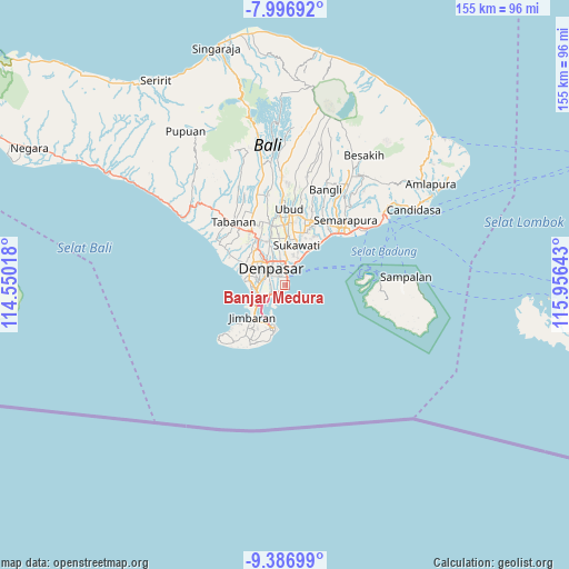
Banjar Medura GPS coordinates[2]
8° 41' 33.36" South, 115° 15' 11.88" East
| Map corner | latitude | longitude |
|---|---|---|
| Upper-left | -7.99692°, | 114.55018° |
| Center: | -8.6926°, | 115.2533° |
| Lower-right: | -9.38699°, | 115.95643° |
| Map W x H: | 154.6×154.6 km | = 96.1×96.1mi |
| max Lat: | 5.88969° ⇑89.1% North |
| Banjar Medura: | -8.6926° |
| min Lat: | ⇓10.9% South -10.934° |
| min Long | Banjar Medura | max Long |
| 95.1345° | 115.2533° | 140.9419° |
| W 73.1%⇐ | ⇒26.9% E |
Elevation
Elevation of Banjar Medura is 9 m = 30 ft, and this is 220.7 m = 724 ft below average elevation for this country.
| Max E: |
3185 m = 10449 ft | 92.1% |
| Avg. | 229.7 m = 754 ft | |
| Banjar Medura | 9 m = 30 ft | |
Min E: |
-1 m = -3 ft | 7.9% |
See also: Indonesia elevation on elevation.city.
Geographical zone
Banjar Medura is located in South Torrid zone (between Equator and Tropic of Capricorn). Distance of Equator is 966.5 km =600.6 mi to North.| Distance of | km | miles | from Banjar Medura |
|---|---|---|---|
| Equator | 966.5 | 600.6 | to North |
| Tropic Capricorn | 1639.4 | 1018.7 | to South |
| Antarctic Circle | 6434.6 | 3998.3 | to South |
| South Pole | 9040.5 | 5617.5 | to South |


Nearby cities:
15 places around Banjar Medura: (largest is in red/bold)
• Banjar Batanpoh
1.9 km =1.2 mi,  15°
15°
• Banjar Jabejero
10.5 km =6.5 mi,  352°
352°
• Banjar Kayangan
8.2 km =5.1 mi,  341°
341°
• Banjar Kertajiwa
5.9 km =3.7 mi,  9°
9°
• Banjar Kertasari
9.2 km =5.7 mi,  328°
328°
• Banjar Paangkelod
7.8 km =4.8 mi, 349°
• Banjar Pasekan
7.4 km =4.6 mi,  26°
26°
• Banjar Pemangkalan
9.6 km =6 mi,  322°
322°
• Banjar Taman
1.2 km =0.7 mi, 15°
• Dajan Tangluk
5.4 km =3.4 mi, 343°
• Denpasar
6.2 km =3.9 mi, 319°
• Jabajero
9.4 km =5.8 mi,  245°
245°
• Karyadharma
4 km =2.5 mi, 252°
• Kuta
9.5 km =5.9 mi, 248°
• Legian
9.2 km =5.7 mi,  261°
261°
Sources, notices
• [Note1] Compared only with cities in Indonesia existing in our database
• [Src1] Map data: © OpenStreetMap contributors (CC-BY-SA)
• [Src2] Other city data from geonames.org with taken over terms of usage.
• [Src3] Geographical zone / Annual Mean Temperature by Robert A. Rohde @ Wikipedia
