Sebasang geodata
Sebasang (West Nusa Tenggara) is a seat of a fourth-order administrative division; located in Indonesia in Asia/Makassar (GMT+8) time zone. In our database, there are 407 cities with bigger population. Compared to other cities in Indonesia, 88.2% of cities are located further ↑North; 79% of cities are located further ←West and 54% of cities have higher elevation than Sebasang. Note1


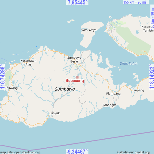
Sebasang GPS coordinates[2]
8° 39' 0.72" South, 117° 26' 45.96" East
| Map corner | latitude | longitude |
|---|---|---|
| Upper-left | -7.95445°, | 116.74298° |
| Center: | -8.6502°, | 117.4461° |
| Lower-right: | -9.34467°, | 118.14923° |
| Map W x H: | 154.6×154.6 km | = 96.1×96.1mi |
| max Lat: | 5.88969° ⇑88.2% North |
| Sebasang: | -8.6502° |
| min Lat: | ⇓11.8% South -10.934° |
| min Long | Sebasang | max Long |
| 95.1345° | 117.4461° | 140.9419° |
| W 79%⇐ | ⇒21% E |
Elevation
Elevation of Sebasang is 89 m = 292 ft, and this is 140.7 m = 462 ft below average elevation for this country.
| Max E: |
3185 m = 10449 ft | 54% |
| Avg. | 229.7 m = 754 ft | |
| Sebasang | 89 m = 292 ft | |
Min E: |
-1 m = -3 ft | 46% |
See also: Indonesia elevation on elevation.city.
Geographical zone
Sebasang is located in South Torrid zone (between Equator and Tropic of Capricorn). Distance of Equator is 961.8 km =597.6 mi to North.| Distance of | km | miles | from Sebasang |
|---|---|---|---|
| Equator | 961.8 | 597.6 | to North |
| Tropic Capricorn | 1644.1 | 1021.6 | to South |
| Antarctic Circle | 6439.4 | 4001.3 | to South |
| South Pole | 9045.2 | 5620.4 | to South |


Nearby cities:
15 places around Sebasang: (largest is in red/bold)
• Batutering
4.1 km =2.5 mi,  116°
116°
• Karangbalong
18 km =11.2 mi,  352°
352°
• Karangbugis
17.3 km =10.7 mi, 351°
• Kelungkung
16.3 km =10.1 mi,  312°
312°
• Kembansari
19.2 km =11.9 mi, 347°
• Lenangguar
13 km =8.1 mi,  223°
223°
• Lopokloka
12.1 km =7.5 mi,  67°
67°
• Ngeru
16.7 km =10.4 mi,  27°
27°
• Poto
17.2 km =10.7 mi,  11°
11°
• Semamung
1.9 km =1.2 mi,  265°
265°
• Semongkat
16.4 km =10.2 mi,  301°
301°
• Sempe Atas
9.2 km =5.7 mi, 266°
• Songkar B
19.2 km =11.9 mi,  17°
17°
• Sumbawa Besar
17.7 km =11 mi, 350°
• Tatebal
15.3 km =9.5 mi, 221°
Sources, notices
• [Note1] Compared only with cities in Indonesia existing in our database
• [Src1] Map data: © OpenStreetMap contributors (CC-BY-SA)
• [Src2] Other city data from geonames.org with taken over terms of usage.
• [Src3] Geographical zone / Annual Mean Temperature by Robert A. Rohde @ Wikipedia
