Tatebal geodata
Tatebal (West Nusa Tenggara) is a seat of a fourth-order administrative division; located in Indonesia in Asia/Makassar (GMT+8) time zone. In our database, there are 407 cities with bigger population. Compared to other cities in Indonesia, 90.5% of cities are located further ↑North; 78.9% of cities are located further ←West and 65% of cities have lower elevation than Tatebal. Note1


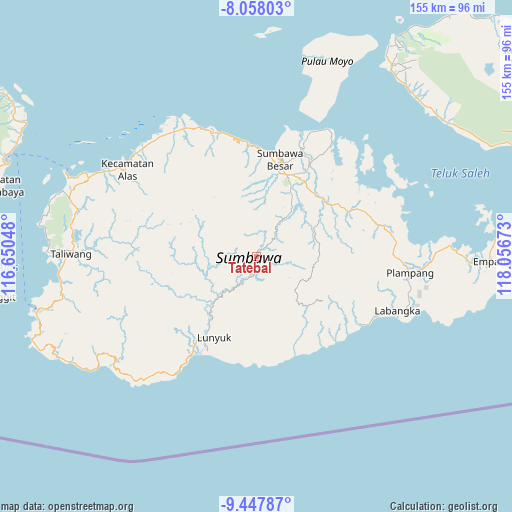
Tatebal GPS coordinates[2]
8° 45' 12.96" South, 117° 21' 12.96" East
| Map corner | latitude | longitude |
|---|---|---|
| Upper-left | -8.05803°, | 116.65048° |
| Center: | -8.7536°, | 117.3536° |
| Lower-right: | -9.44787°, | 118.05673° |
| Map W x H: | 154.5×154.5 km | = 96×96mi |
| max Lat: | 5.88969° ⇑90.5% North |
| Tatebal: | -8.7536° |
| min Lat: | ⇓9.5% South -10.934° |
| min Long | Tatebal | max Long |
| 95.1345° | 117.3536° | 140.9419° |
| W 78.9%⇐ | ⇒21.1% E |
Elevation
Elevation of Tatebal is 222 m = 728 ft, and this is 7.7 m = 25 ft below average elevation for this country.
| Max E: |
3185 m = 10449 ft | 35% |
| Avg. | 229.7 m = 754 ft | |
| Tatebal | 222 m = 728 ft | |
Min E: |
-1 m = -3 ft | 65% |
See also: Indonesia elevation on elevation.city.
Geographical zone
Tatebal is located in South Torrid zone (between Equator and Tropic of Capricorn). Distance of Equator is 973.3 km =604.8 mi to North.| Distance of | km | miles | from Tatebal |
|---|---|---|---|
| Equator | 973.3 | 604.8 | to North |
| Tropic Capricorn | 1632.6 | 1014.5 | to South |
| Antarctic Circle | 6427.9 | 3994.1 | to South |
| South Pole | 9033.8 | 5613.3 | to South |


Nearby cities:
15 places around Tatebal: (largest is in red/bold)
• Baodesasampar
25.7 km =16 mi,  299°
299°
• Batudulang
20.1 km =12.5 mi,  336°
336°
• Baturotok
24.8 km =15.4 mi,  293°
293°
• Batutering
16.9 km =10.5 mi,  54°
54°
• Kelungkung
22.5 km =14 mi,  355°
355°
• Lenangguar
2.4 km =1.5 mi,  32°
32°
• Lopokloka
26.8 km =16.7 mi, 52°
• Mungkin
24.9 km =15.5 mi,  270°
270°
• Sebasang
15.3 km =9.5 mi,  41°
41°
• Semamung
14 km =8.7 mi, 36°
• Semongkat
20.5 km =12.7 mi,  349°
349°
• Sempe Atas
11.1 km =6.9 mi,  5°
5°
• Sobeok
18.4 km =11.4 mi, 268°
• Tangkanpulit
22.3 km =13.9 mi, 297°
• Tepal
23.9 km =14.9 mi,  306°
306°
Sources, notices
• [Note1] Compared only with cities in Indonesia existing in our database
• [Src1] Map data: © OpenStreetMap contributors (CC-BY-SA)
• [Src2] Other city data from geonames.org with taken over terms of usage.
• [Src3] Geographical zone / Annual Mean Temperature by Robert A. Rohde @ Wikipedia
