Semongkat geodata
Semongkat (West Nusa Tenggara) is a seat of a third-order administrative division; located in Indonesia in Asia/Makassar (GMT+8) time zone. In our database, there are 407 cities with bigger population. Compared to other cities in Indonesia, 86.1% of cities are located further ↑North; 78.8% of cities are located further ←West and 71.8% of cities have lower elevation than Semongkat. Note1


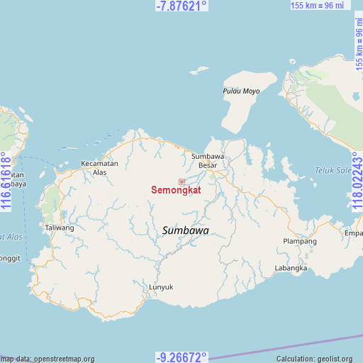
Semongkat GPS coordinates[2]
8° 34' 19.56" South, 117° 19' 9.48" East
| Map corner | latitude | longitude |
|---|---|---|
| Upper-left | -7.87621°, | 116.61618° |
| Center: | -8.5721°, | 117.3193° |
| Lower-right: | -9.26672°, | 118.02243° |
| Map W x H: | 154.6×154.6 km | = 96.1×96.1mi |
| max Lat: | 5.88969° ⇑86.1% North |
| Semongkat: | -8.5721° |
| min Lat: | ⇓13.9% South -10.934° |
| min Long | Semongkat | max Long |
| 95.1345° | 117.3193° | 140.9419° |
| W 78.8%⇐ | ⇒21.2% E |
Elevation
Elevation of Semongkat is 319 m = 1047 ft, and this is 89.3 m = 293 ft above average elevation for this country.
| Max E: |
3185 m = 10449 ft | 28.2% |
| Semongkat | 319 m 1047 ft | |
| Avg. | 229.7 m = 754 ft | |
Min E: |
-1 m = -3 ft | 71.8% |
See also: Indonesia elevation on elevation.city.
Geographical zone
Semongkat is located in South Torrid zone (between Equator and Tropic of Capricorn). Distance of Equator is 953.1 km =592.2 mi to North.| Distance of | km | miles | from Semongkat |
|---|---|---|---|
| Equator | 953.1 | 592.2 | to North |
| Tropic Capricorn | 1652.8 | 1027 | to South |
| Antarctic Circle | 6448 | 4006.6 | to South |
| South Pole | 9053.9 | 5625.8 | to South |


Nearby cities:
15 places around Semongkat: (largest is in red/bold)
• Batudulang
4.5 km =2.8 mi,  248°
248°
• Karangbalong
14.8 km =9.2 mi,  51°
51°
• Karangbugis
14.1 km =8.8 mi, 53°
• Karangdima
13.4 km =8.3 mi,  36°
36°
• Kelungkung
3 km =1.9 mi, 40°
• Kembansari
14.2 km =8.8 mi, 44°
• Labuhanbadas
13.2 km =8.2 mi,  23°
23°
• Labuhansumbawa
14.3 km =8.9 mi, 39°
• Lukkarya
16.3 km =10.1 mi,  347°
347°
• Osapsio
14.6 km =9.1 mi, 44°
• Sebasang
16.4 km =10.2 mi,  121°
121°
• Semamung
14.9 km =9.3 mi,  126°
126°
• Sempe Atas
10.3 km =6.4 mi,  152°
152°
• Seseng
15.2 km =9.4 mi,  319°
319°
• Sumbawa Besar
14.1 km =8.8 mi, 51°
Sources, notices
• [Note1] Compared only with cities in Indonesia existing in our database
• [Src1] Map data: © OpenStreetMap contributors (CC-BY-SA)
• [Src2] Other city data from geonames.org with taken over terms of usage.
• [Src3] Geographical zone / Annual Mean Temperature by Robert A. Rohde @ Wikipedia
