Banjar Triwangsakelusa geodata
Banjar Triwangsakelusa (Bali) is a seat of a fourth-order administrative division; located in Indonesia in Asia/Makassar (GMT+8) time zone. In our database, there are 407 cities with bigger population. Compared to other cities in Indonesia, 81.5% of cities are located further ↑North; 73.1% of cities are located further ←West and 78.5% of cities have lower elevation than Banjar Triwangsakelusa. Note1


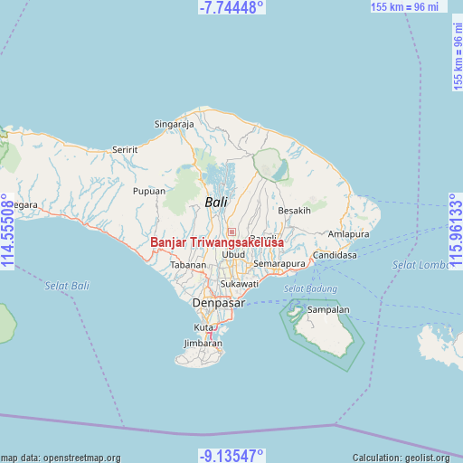
Banjar Triwangsakelusa GPS coordinates[2]
8° 26' 26.16" South, 115° 15' 29.52" East
| Map corner | latitude | longitude |
|---|---|---|
| Upper-left | -7.74448°, | 114.55508° |
| Center: | -8.4406°, | 115.2582° |
| Lower-right: | -9.13547°, | 115.96133° |
| Map W x H: | 154.7×154.7 km | = 96.1×96.1mi |
| max Lat: | 5.88969° ⇑81.5% North |
| Banjar Triwangsakelusa: | -8.4406° |
| min Lat: | ⇓18.5% South -10.934° |
| min Long | Banjar Triwangs | max Long |
| 95.1345° | 115.2582° | 140.9419° |
| W 73.1%⇐ | ⇒26.9% E |
Elevation
Elevation of Banjar Triwangsakelusa is 405 m = 1329 ft, and this is 175.3 m = 575 ft above average elevation for this country.
| Max E: |
3185 m = 10449 ft | 21.5% |
| Banjar Triwangsakelusa | 405 m 1329 ft | |
| Avg. | 229.7 m = 754 ft | |
Min E: |
-1 m = -3 ft | 78.5% |
See also: Indonesia elevation on elevation.city.
Geographical zone
Banjar Triwangsakelusa is located in South Torrid zone (between Equator and Tropic of Capricorn). Distance of Equator is 938.5 km =583.2 mi to North.| Distance of | km | miles | from Banjar Triwangsakelusa |
|---|---|---|---|
| Equator | 938.5 | 583.2 | to North |
| Tropic Capricorn | 1667.4 | 1036.1 | to South |
| Antarctic Circle | 6462.7 | 4015.7 | to South |
| South Pole | 9068.6 | 5635 | to South |


Nearby cities:
15 places around Banjar Triwangsakelusa: (largest is in red/bold)
• Banjar Buahan
5.6 km =3.5 mi,  335°
335°
• Banjar Bukian
3.8 km =2.4 mi,  11°
11°
• Banjar Dujung Kaja
5.5 km =3.4 mi,  37°
37°
• Banjar Kedisan Kelod
4.3 km =2.7 mi,  61°
61°
• Banjar Petuludesa
5.4 km =3.4 mi,  161°
161°
• Banjar Sandinggianyar
5.1 km =3.2 mi,  118°
118°
• Banjar Tengah
3.6 km =2.2 mi,  108°
108°
• Banjar Triwangsakeliki
1.3 km =0.8 mi, 161°
• Banjar Ubud
5.5 km =3.4 mi,  135°
135°
• Bayad
2 km =1.2 mi,  248°
248°
• Bunutan
2.9 km =1.8 mi,  202°
202°
• Melinggih
1.8 km =1.1 mi,  304°
304°
• Pangsan
5 km =3.1 mi,  305°
305°
• Pemijian
4.4 km =2.7 mi,  256°
256°
• Tegalalang
2.4 km =1.5 mi,  79°
79°
Sources, notices
• [Note1] Compared only with cities in Indonesia existing in our database
• [Src1] Map data: © OpenStreetMap contributors (CC-BY-SA)
• [Src2] Other city data from geonames.org with taken over terms of usage.
• [Src3] Geographical zone / Annual Mean Temperature by Robert A. Rohde @ Wikipedia
