Nuajena geodata
Nuajena (East Nusa Tenggara) is a seat of a fourth-order administrative division; located in Indonesia in Asia/Makassar (GMT+8) time zone. In our database, there are 407 cities with bigger population. Compared to other cities in Indonesia, 90% of cities are located further ↑North; 87.4% of cities are located further ←West and 91.4% of cities have lower elevation than Nuajena. Note1


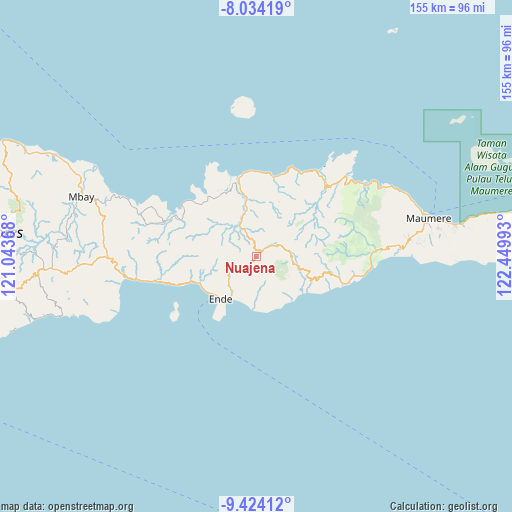
Nuajena GPS coordinates[2]
8° 43' 47.28" South, 121° 44' 48.48" East
| Map corner | latitude | longitude |
|---|---|---|
| Upper-left | -8.03419°, | 121.04368° |
| Center: | -8.7298°, | 121.7468° |
| Lower-right: | -9.42412°, | 122.44993° |
| Map W x H: | 154.5×154.5 km | = 96×96mi |
| max Lat: | 5.88969° ⇑90% North |
| Nuajena: | -8.7298° |
| min Lat: | ⇓10% South -10.934° |
| min Long | Nuajena | max Long |
| 95.1345° | 121.7468° | 140.9419° |
| W 87.4%⇐ | ⇒12.6% E |
Elevation
Elevation of Nuajena is 690 m = 2264 ft, and this is 460.3 m = 1510 ft above average elevation for this country.
| Max E: |
3185 m = 10449 ft | 8.6% |
| Nuajena | 690 m 2264 ft | |
| Avg. | 229.7 m = 754 ft | |
Min E: |
-1 m = -3 ft | 91.4% |
See also: Indonesia elevation on elevation.city.
Geographical zone
Nuajena is located in South Torrid zone (between Equator and Tropic of Capricorn). Distance of Equator is 970.7 km =603.2 mi to North.| Distance of | km | miles | from Nuajena |
|---|---|---|---|
| Equator | 970.7 | 603.2 | to North |
| Tropic Capricorn | 1635.3 | 1016.1 | to South |
| Antarctic Circle | 6430.5 | 3995.7 | to South |
| South Pole | 9036.4 | 5615 | to South |


Nearby cities:
15 places around Nuajena: (largest is in red/bold)
• Aefeo
8.8 km =5.5 mi,  245°
245°
• Detumbawa
10.3 km =6.4 mi,  232°
232°
• Detusoko
2.1 km =1.3 mi,  46°
46°
• Kengga
4.9 km =3 mi, 227°
• Koanara
11.8 km =7.3 mi,  100°
100°
• Mbani
11.2 km =7 mi,  296°
296°
• Nduaria
9.2 km =5.7 mi,  77°
77°
• Nuakota
12.3 km =7.6 mi,  206°
206°
• Puutuga
8.5 km =5.3 mi,  197°
197°
• Roa
4.3 km =2.7 mi, 226°
• Saga
4.6 km =2.9 mi, 196°
• Tendaleo
10.5 km =6.5 mi,  330°
330°
• Wolofeo
7.3 km =4.5 mi,  274°
274°
• Wolomage
3.2 km =2 mi,  338°
338°
• Wolomoni
1.5 km =0.9 mi,  189°
189°
Sources, notices
• [Note1] Compared only with cities in Indonesia existing in our database
• [Src1] Map data: © OpenStreetMap contributors (CC-BY-SA)
• [Src2] Other city data from geonames.org with taken over terms of usage.
• [Src3] Geographical zone / Annual Mean Temperature by Robert A. Rohde @ Wikipedia
