Heret geodata
Heret (East Nusa Tenggara) is a seat of a fourth-order administrative division; located in Indonesia in Asia/Makassar (GMT+8) time zone. In our database, there are 407 cities with bigger population. Compared to other cities in Indonesia, 80.6% of cities are located further ↑North; 84.7% of cities are located further ←West and 82.8% of cities have lower elevation than Heret. Note1


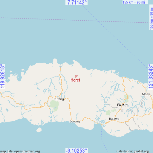
Heret GPS coordinates[2]
8° 24' 27.36" South, 120° 37' 45.48" East
| Map corner | latitude | longitude |
|---|---|---|
| Upper-left | -7.71142°, | 119.92618° |
| Center: | -8.4076°, | 120.6293° |
| Lower-right: | -9.10253°, | 121.33243° |
| Map W x H: | 154.7×154.7 km | = 96.1×96.1mi |
| max Lat: | 5.88969° ⇑80.6% North |
| Heret: | -8.4076° |
| min Lat: | ⇓19.4% South -10.934° |
| min Long | Heret | max Long |
| 95.1345° | 120.6293° | 140.9419° |
| W 84.7%⇐ | ⇒15.3% E |
Elevation
Elevation of Heret is 476 m = 1562 ft, and this is 246.3 m = 808 ft above average elevation for this country.
| Max E: |
3185 m = 10449 ft | 17.2% |
| Heret | 476 m 1562 ft | |
| Avg. | 229.7 m = 754 ft | |
Min E: |
-1 m = -3 ft | 82.8% |
See also: Indonesia elevation on elevation.city.
Geographical zone
Heret is located in South Torrid zone (between Equator and Tropic of Capricorn). Distance of Equator is 934.8 km =580.9 mi to North.| Distance of | km | miles | from Heret |
|---|---|---|---|
| Equator | 934.8 | 580.9 | to North |
| Tropic Capricorn | 1671.1 | 1038.4 | to South |
| Antarctic Circle | 6466.3 | 4018 | to South |
| South Pole | 9072.2 | 5637.2 | to South |


Nearby cities:
15 places around Heret: (largest is in red/bold)
• Bentengjawa
8.3 km =5.2 mi,  228°
228°
• Buti
13.4 km =8.3 mi,  141°
141°
• Dampek
12.5 km =7.8 mi,  341°
341°
• Golopau
8.7 km =5.4 mi,  268°
268°
• Kenca
10.6 km =6.6 mi, 226°
• Lengkoajang
12.4 km =7.7 mi,  153°
153°
• Necak
9.4 km =5.8 mi,  186°
186°
• Rado
8.7 km =5.4 mi, 148°
• Rentung
10.3 km =6.4 mi,  237°
237°
• Reweng
10.3 km =6.4 mi,  171°
171°
• Waenenda
5.2 km =3.2 mi, 171°
• Waetuwa
4 km =2.5 mi,  320°
320°
• Waso
5.4 km =3.4 mi, 242°
• Weleng
11.7 km =7.3 mi, 271°
• Wera
12.5 km =7.8 mi,  53°
53°
Sources, notices
• [Note1] Compared only with cities in Indonesia existing in our database
• [Src1] Map data: © OpenStreetMap contributors (CC-BY-SA)
• [Src2] Other city data from geonames.org with taken over terms of usage.
• [Src3] Geographical zone / Annual Mean Temperature by Robert A. Rohde @ Wikipedia
