Rentung geodata
Rentung (East Nusa Tenggara) is a seat of a fourth-order administrative division; located in Indonesia in Asia/Makassar (GMT+8) time zone. In our database, there are 407 cities with bigger population. Compared to other cities in Indonesia, 82% of cities are located further ↑North; 84.4% of cities are located further ←West and 88% of cities have lower elevation than Rentung. Note1


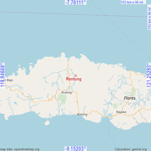
Rentung GPS coordinates[2]
8° 27' 25.92" South, 120° 32' 59.28" East
| Map corner | latitude | longitude |
|---|---|---|
| Upper-left | -7.76111°, | 119.84668° |
| Center: | -8.4572°, | 120.5498° |
| Lower-right: | -9.15203°, | 121.25293° |
| Map W x H: | 154.7×154.7 km | = 96.1×96.1mi |
| max Lat: | 5.88969° ⇑82% North |
| Rentung: | -8.4572° |
| min Lat: | ⇓18% South -10.934° |
| min Long | Rentung | max Long |
| 95.1345° | 120.5498° | 140.9419° |
| W 84.4%⇐ | ⇒15.6% E |
Elevation
Elevation of Rentung is 584 m = 1916 ft, and this is 354.3 m = 1162 ft above average elevation for this country.
| Max E: |
3185 m = 10449 ft | 12% |
| Rentung | 584 m 1916 ft | |
| Avg. | 229.7 m = 754 ft | |
Min E: |
-1 m = -3 ft | 88% |
See also: Indonesia elevation on elevation.city.
Geographical zone
Rentung is located in South Torrid zone (between Equator and Tropic of Capricorn). Distance of Equator is 940.4 km =584.3 mi to North.| Distance of | km | miles | from Rentung |
|---|---|---|---|
| Equator | 940.4 | 584.3 | to North |
| Tropic Capricorn | 1665.6 | 1035 | to South |
| Antarctic Circle | 6460.8 | 4014.6 | to South |
| South Pole | 9066.7 | 5633.8 | to South |


Nearby cities:
15 places around Rentung: (largest is in red/bold)
• Bentengjawa
2.5 km =1.6 mi,  89°
89°
• Golomunta
4.1 km =2.5 mi,  260°
260°
• Golopau
5.2 km =3.2 mi,  0°
0°
• Heret
10.3 km =6.4 mi,  57°
57°
• Jawa
15.1 km =9.4 mi,  140°
140°
• Kenca
2 km =1.2 mi,  149°
149°
• Lengkoajang
15.3 km =9.5 mi,  111°
111°
• Moso
4.8 km =3 mi,  240°
240°
• Necak
8.5 km =5.3 mi,  116°
116°
• Rado
13.4 km =8.3 mi,  97°
97°
• Reweng
11.4 km =7.1 mi, 114°
• Waenenda
9.5 km =5.9 mi, 87°
• Waetuwa
10.6 km =6.6 mi,  35°
35°
• Waso
5 km =3.1 mi,  52°
52°
• Weleng
6.5 km =4 mi,  333°
333°
Sources, notices
• [Note1] Compared only with cities in Indonesia existing in our database
• [Src1] Map data: © OpenStreetMap contributors (CC-BY-SA)
• [Src2] Other city data from geonames.org with taken over terms of usage.
• [Src3] Geographical zone / Annual Mean Temperature by Robert A. Rohde @ Wikipedia
