Bungkulan geodata
Bungkulan (Bali) is a seat of a fourth-order administrative division; located in Indonesia in Asia/Makassar (GMT+8) time zone. In our database, there are 407 cities with bigger population. Compared to other cities in Indonesia, 81.6% of cities are located further ↑North; 75.6% of cities are located further ←West and 52% of cities have higher elevation than Bungkulan. Note1


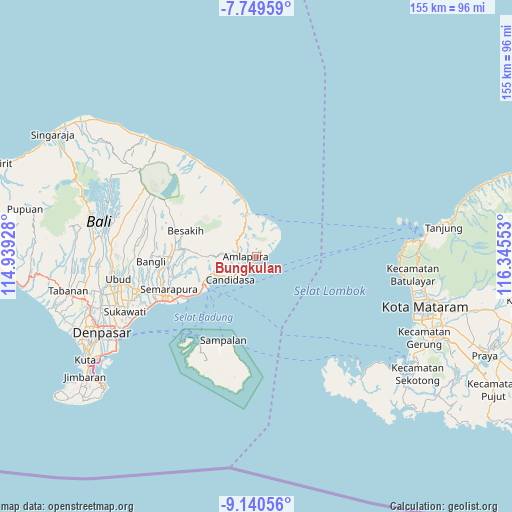
Bungkulan GPS coordinates[2]
8° 26' 44.52" South, 115° 38' 32.64" East
| Map corner | latitude | longitude |
|---|---|---|
| Upper-left | -7.74959°, | 114.93928° |
| Center: | -8.4457°, | 115.6424° |
| Lower-right: | -9.14056°, | 116.34553° |
| Map W x H: | 154.7×154.7 km | = 96.1×96.1mi |
| max Lat: | 5.88969° ⇑81.6% North |
| Bungkulan: | -8.4457° |
| min Lat: | ⇓18.4% South -10.934° |
| min Long | Bungkulan | max Long |
| 95.1345° | 115.6424° | 140.9419° |
| W 75.6%⇐ | ⇒24.4% E |
Elevation
Elevation of Bungkulan is 95 m = 312 ft, and this is 134.7 m = 442 ft below average elevation for this country.
| Max E: |
3185 m = 10449 ft | 52% |
| Avg. | 229.7 m = 754 ft | |
| Bungkulan | 95 m = 312 ft | |
Min E: |
-1 m = -3 ft | 48% |
See also: Indonesia elevation on elevation.city.
Geographical zone
Bungkulan is located in South Torrid zone (between Equator and Tropic of Capricorn). Distance of Equator is 939.1 km =583.5 mi to North.| Distance of | km | miles | from Bungkulan |
|---|---|---|---|
| Equator | 939.1 | 583.5 | to North |
| Tropic Capricorn | 1666.8 | 1035.7 | to South |
| Antarctic Circle | 6462.1 | 4015.4 | to South |
| South Pole | 9068 | 5634.6 | to South |


Nearby cities:
15 places around Bungkulan: (largest is in red/bold)
• Amlapura
2.9 km =1.8 mi,  260°
260°
• Amlapura city
4 km =2.5 mi,  265°
265°
• Banjar Ababi
7.7 km =4.8 mi,  305°
305°
• Banjar Beji
6.8 km =4.2 mi, 258°
• Banjar Budakeling
8 km =5 mi,  284°
284°
• Banjar Bugbug
7.2 km =4.5 mi,  228°
228°
• Banjar Danginsema
2.9 km =1.8 mi, 259°
• Banjar Genteng
4.7 km =2.9 mi, 255°
• Banjar Timbrah
6.1 km =3.8 mi, 234°
• Bedugul
5.5 km =3.4 mi, 264°
• Seraya
2.4 km =1.5 mi,  44°
44°
• Subagan
4 km =2.5 mi, 262°
• Tibulakasasak
2.8 km =1.7 mi,  332°
332°
• Tiyingtali Kelod
4.8 km =3 mi,  322°
322°
• Tumbukebon
2 km =1.2 mi, 272°
Sources, notices
• [Note1] Compared only with cities in Indonesia existing in our database
• [Src1] Map data: © OpenStreetMap contributors (CC-BY-SA)
• [Src2] Other city data from geonames.org with taken over terms of usage.
• [Src3] Geographical zone / Annual Mean Temperature by Robert A. Rohde @ Wikipedia
