Seraya geodata
Seraya (Bali) is a seat of a fourth-order administrative division; located in Indonesia in Asia/Makassar (GMT+8) time zone. In our database, there are 407 cities with bigger population. Compared to other cities in Indonesia, 81.1% of cities are located further ↑North; 75.7% of cities are located further ←West and 64.4% of cities have lower elevation than Seraya. Note1


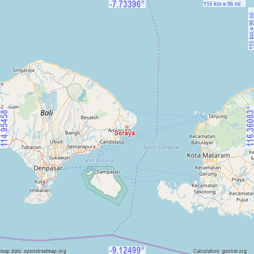
Seraya GPS coordinates[2]
8° 25' 48.36" South, 115° 39' 27.72" East
| Map corner | latitude | longitude |
|---|---|---|
| Upper-left | -7.73396°, | 114.95458° |
| Center: | -8.4301°, | 115.6577° |
| Lower-right: | -9.12499°, | 116.36083° |
| Map W x H: | 154.7×154.7 km | = 96.1×96.1mi |
| max Lat: | 5.88969° ⇑81.1% North |
| Seraya: | -8.4301° |
| min Lat: | ⇓18.9% South -10.934° |
| min Long | Seraya | max Long |
| 95.1345° | 115.6577° | 140.9419° |
| W 75.7%⇐ | ⇒24.3% E |
Elevation
Elevation of Seraya is 214 m = 702 ft, and this is 15.7 m = 52 ft below average elevation for this country.
| Max E: |
3185 m = 10449 ft | 35.6% |
| Avg. | 229.7 m = 754 ft | |
| Seraya | 214 m = 702 ft | |
Min E: |
-1 m = -3 ft | 64.4% |
See also: Indonesia elevation on elevation.city.
Geographical zone
Seraya is located in South Torrid zone (between Equator and Tropic of Capricorn). Distance of Equator is 937.3 km =582.4 mi to North.| Distance of | km | miles | from Seraya |
|---|---|---|---|
| Equator | 937.3 | 582.4 | to North |
| Tropic Capricorn | 1668.6 | 1036.8 | to South |
| Antarctic Circle | 6463.8 | 4016.4 | to South |
| South Pole | 9069.7 | 5635.6 | to South |


Nearby cities:
15 places around Seraya: (largest is in red/bold)
• Abang
7.9 km =4.9 mi,  307°
307°
• Amlapura
5 km =3.1 mi,  243°
243°
• Amlapura city
6 km =3.7 mi,  249°
249°
• Banjar Ababi
8.4 km =5.2 mi,  288°
288°
• Banjar Beji
8.9 km =5.5 mi, 249°
• Banjar Danginsema
5.1 km =3.2 mi, 243°
• Banjar Genteng
6.9 km =4.3 mi, 245°
• Banjar Timbrah
8.5 km =5.3 mi,  231°
231°
• Bedugul
7.5 km =4.7 mi, 252°
• Bungkulan
2.4 km =1.5 mi,  224°
224°
• Subagan
6.1 km =3.8 mi, 248°
• Tibulakasasak
3 km =1.9 mi,  284°
284°
• Tistagede
7.8 km =4.8 mi,  316°
316°
• Tiyingtali Kelod
5.1 km =3.2 mi, 294°
• Tumbukebon
4 km =2.5 mi, 245°
Sources, notices
• [Note1] Compared only with cities in Indonesia existing in our database
• [Src1] Map data: © OpenStreetMap contributors (CC-BY-SA)
• [Src2] Other city data from geonames.org with taken over terms of usage.
• [Src3] Geographical zone / Annual Mean Temperature by Robert A. Rohde @ Wikipedia
