Rentung geodata
Rentung (East Nusa Tenggara) is a seat of a fourth-order administrative division; located in Indonesia in Asia/Makassar (GMT+8) time zone. In our database, there are 407 cities with bigger population. Compared to other cities in Indonesia, 88.7% of cities are located further ↑North; 84.5% of cities are located further ←West and 96.7% of cities have lower elevation than Rentung. Note1


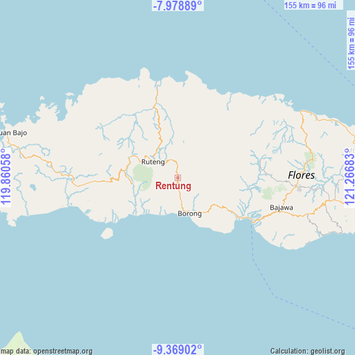
Rentung GPS coordinates[2]
8° 40' 28.56" South, 120° 33' 49.32" East
| Map corner | latitude | longitude |
|---|---|---|
| Upper-left | -7.97889°, | 119.86058° |
| Center: | -8.6746°, | 120.5637° |
| Lower-right: | -9.36902°, | 121.26683° |
| Map W x H: | 154.6×154.6 km | = 96.1×96.1mi |
| max Lat: | 5.88969° ⇑88.7% North |
| Rentung: | -8.6746° |
| min Lat: | ⇓11.3% South -10.934° |
| min Long | Rentung | max Long |
| 95.1345° | 120.5637° | 140.9419° |
| W 84.5%⇐ | ⇒15.5% E |
Elevation
Elevation of Rentung is 924 m = 3031 ft, and this is 694.3 m = 2278 ft above average elevation for this country.
| Max E: |
3185 m = 10449 ft | 3.3% |
| Rentung | 924 m 3031 ft | |
| Avg. | 229.7 m = 754 ft | |
Min E: |
-1 m = -3 ft | 96.7% |
See also: Indonesia elevation on elevation.city.
Geographical zone
Rentung is located in South Torrid zone (between Equator and Tropic of Capricorn). Distance of Equator is 964.5 km =599.3 mi to North.| Distance of | km | miles | from Rentung |
|---|---|---|---|
| Equator | 964.5 | 599.3 | to North |
| Tropic Capricorn | 1641.4 | 1019.9 | to South |
| Antarctic Circle | 6436.6 | 3999.5 | to South |
| South Pole | 9042.5 | 5618.7 | to South |


Nearby cities:
15 places around Rentung: (largest is in red/bold)
• Biting
11.6 km =7.2 mi,  41°
41°
• Bombu
5.5 km =3.4 mi,  250°
250°
• Gurung
13.5 km =8.4 mi,  142°
142°
• Kaca
6.9 km =4.3 mi,  172°
172°
• Kawit
5.4 km =3.4 mi,  193°
193°
• Lewe
11.8 km =7.3 mi,  130°
130°
• Lurut
10.8 km =6.7 mi,  76°
76°
• Ngusu
12.9 km =8 mi,  105°
105°
• Ntaur Satu
4.2 km =2.6 mi,  244°
244°
• Pesek
6.9 km =4.3 mi,  120°
120°
• Ruteng
13 km =8.1 mi,  302°
302°
• Tado
4.6 km =2.9 mi, 130°
• Teber
3.9 km =2.4 mi,  58°
58°
• Waling
8.7 km =5.4 mi,  69°
69°
• Wasogolo
12.6 km =7.8 mi,  294°
294°
Sources, notices
• [Note1] Compared only with cities in Indonesia existing in our database
• [Src1] Map data: © OpenStreetMap contributors (CC-BY-SA)
• [Src2] Other city data from geonames.org with taken over terms of usage.
• [Src3] Geographical zone / Annual Mean Temperature by Robert A. Rohde @ Wikipedia
