Bombu geodata
Bombu (East Nusa Tenggara) is a seat of a fourth-order administrative division; located in Indonesia in Asia/Makassar (GMT+8) time zone. In our database, there are 407 cities with bigger population. Compared to other cities in Indonesia, 89.1% of cities are located further ↑North; 84.3% of cities are located further ←West and 94.8% of cities have lower elevation than Bombu. Note1


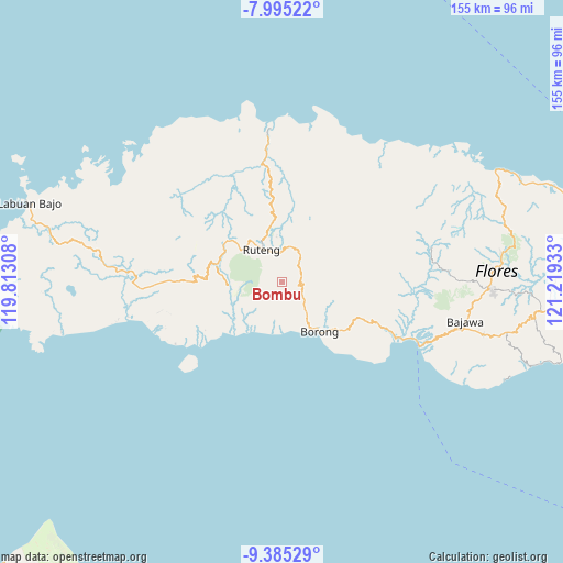
Bombu GPS coordinates[2]
8° 41' 27.24" South, 120° 30' 58.32" East
| Map corner | latitude | longitude |
|---|---|---|
| Upper-left | -7.99522°, | 119.81308° |
| Center: | -8.6909°, | 120.5162° |
| Lower-right: | -9.38529°, | 121.21933° |
| Map W x H: | 154.6×154.6 km | = 96.1×96.1mi |
| max Lat: | 5.88969° ⇑89.1% North |
| Bombu: | -8.6909° |
| min Lat: | ⇓10.9% South -10.934° |
| min Long | Bombu | max Long |
| 95.1345° | 120.5162° | 140.9419° |
| W 84.3%⇐ | ⇒15.7% E |
Elevation
Elevation of Bombu is 806 m = 2644 ft, and this is 576.3 m = 1891 ft above average elevation for this country.
| Max E: |
3185 m = 10449 ft | 5.2% |
| Bombu | 806 m 2644 ft | |
| Avg. | 229.7 m = 754 ft | |
Min E: |
-1 m = -3 ft | 94.8% |
See also: Indonesia elevation on elevation.city.
Geographical zone
Bombu is located in South Torrid zone (between Equator and Tropic of Capricorn). Distance of Equator is 966.3 km =600.4 mi to North.| Distance of | km | miles | from Bombu |
|---|---|---|---|
| Equator | 966.3 | 600.4 | to North |
| Tropic Capricorn | 1639.6 | 1018.8 | to South |
| Antarctic Circle | 6434.8 | 3998.4 | to South |
| South Pole | 9040.7 | 5617.6 | to South |


Nearby cities:
15 places around Bombu: (largest is in red/bold)
• Kaca
7.9 km =4.9 mi,  129°
129°
• Kawit
5.2 km =3.2 mi, 130°
• Ntaur Satu
1.5 km =0.9 mi,  90°
90°
• Paka
14.5 km =9 mi,  227°
227°
• Pesek
11.3 km =7 mi,  98°
98°
• Ponggeok
11.7 km =7.3 mi,  252°
252°
• Pongkor
14.3 km =8.9 mi,  259°
259°
• Rentung
5.5 km =3.4 mi,  70°
70°
• Ruteng
10.5 km =6.5 mi,  327°
327°
• Tado
8.8 km =5.5 mi, 97°
• Teber
9.4 km =5.8 mi, 65°
• Waling
14.2 km =8.8 mi, 69°
• Wasogolo
9.4 km =5.8 mi,  319°
319°
• Watuweri
11.5 km =7.1 mi,  205°
205°
• Woa
12 km =7.5 mi,  188°
188°
Sources, notices
• [Note1] Compared only with cities in Indonesia existing in our database
• [Src1] Map data: © OpenStreetMap contributors (CC-BY-SA)
• [Src2] Other city data from geonames.org with taken over terms of usage.
• [Src3] Geographical zone / Annual Mean Temperature by Robert A. Rohde @ Wikipedia
