Samangawah geodata
Samangawah (West Nusa Tenggara) is a seat of a fourth-order administrative division; located in Indonesia in Asia/Makassar (GMT+8) time zone. In our database, there are 407 cities with bigger population. Compared to other cities in Indonesia, 83.2% of cities are located further ↑North; 79.6% of cities are located further ←West and 54.7% of cities have lower elevation than Samangawah. Note1


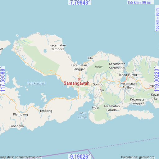
Samangawah GPS coordinates[2]
8° 29' 43.8" South, 118° 17' 56.76" East
| Map corner | latitude | longitude |
|---|---|---|
| Upper-left | -7.79948°, | 117.59598° |
| Center: | -8.4955°, | 118.2991° |
| Lower-right: | -9.19026°, | 119.00223° |
| Map W x H: | 154.6×154.6 km | = 96.1×96.1mi |
| max Lat: | 5.88969° ⇑83.2% North |
| Samangawah: | -8.4955° |
| min Lat: | ⇓16.8% South -10.934° |
| min Long | Samangawah | max Long |
| 95.1345° | 118.2991° | 140.9419° |
| W 79.6%⇐ | ⇒20.4% E |
Elevation
Elevation of Samangawah is 123 m = 404 ft, and this is 106.7 m = 350 ft below average elevation for this country.
| Max E: |
3185 m = 10449 ft | 45.3% |
| Avg. | 229.7 m = 754 ft | |
| Samangawah | 123 m = 404 ft | |
Min E: |
-1 m = -3 ft | 54.7% |
See also: Indonesia elevation on elevation.city.
Geographical zone
Samangawah is located in South Torrid zone (between Equator and Tropic of Capricorn). Distance of Equator is 944.6 km =586.9 mi to North.| Distance of | km | miles | from Samangawah |
|---|---|---|---|
| Equator | 944.6 | 586.9 | to North |
| Tropic Capricorn | 1661.3 | 1032.3 | to South |
| Antarctic Circle | 6456.6 | 4011.9 | to South |
| South Pole | 9062.5 | 5631.2 | to South |


Nearby cities:
15 places around Samangawah: (largest is in red/bold)
• Kalate
7.8 km =4.8 mi,  227°
227°
• Kambu
12.4 km =7.7 mi,  11°
11°
• Kempo
7.7 km =4.8 mi, 226°
• Kesi
12.5 km =7.8 mi,  250°
250°
• Konte
9 km =5.6 mi, 232°
• Kore
13.3 km =8.3 mi,  359°
359°
• Lanci Satu
2.1 km =1.3 mi,  82°
82°
• Npongge
6.4 km =4 mi,  186°
186°
• Nusajaya
1.7 km =1.1 mi,  27°
27°
• Pali
13.3 km =8.3 mi,  4°
4°
• Rasabou
6.7 km =4.2 mi, 226°
• Soriutu
3.7 km =2.3 mi,  135°
135°
• Soro
9.6 km =6 mi,  224°
224°
• Sumur Lima
0.2 km =0.1 mi, 0°
• Taloko
10.7 km =6.6 mi, 10°
Sources, notices
• [Note1] Compared only with cities in Indonesia existing in our database
• [Src1] Map data: © OpenStreetMap contributors (CC-BY-SA)
• [Src2] Other city data from geonames.org with taken over terms of usage.
• [Src3] Geographical zone / Annual Mean Temperature by Robert A. Rohde @ Wikipedia
