Kesi geodata
Kesi (West Nusa Tenggara) is a seat of a fourth-order administrative division; located in Indonesia in Asia/Makassar (GMT+8) time zone. In our database, there are 407 cities with bigger population. Compared to other cities in Indonesia, 84.7% of cities are located further ↑North; 79.4% of cities are located further ←West and 84.2% of cities have higher elevation than Kesi. Note1


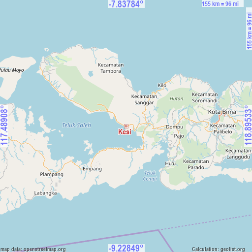
Kesi GPS coordinates[2]
8° 32' 1.68" South, 118° 11' 31.92" East
| Map corner | latitude | longitude |
|---|---|---|
| Upper-left | -7.83784°, | 117.48908° |
| Center: | -8.5338°, | 118.1922° |
| Lower-right: | -9.22849°, | 118.89533° |
| Map W x H: | 154.6×154.6 km | = 96.1×96.1mi |
| max Lat: | 5.88969° ⇑84.7% North |
| Kesi: | -8.5338° |
| min Lat: | ⇓15.3% South -10.934° |
| min Long | Kesi | max Long |
| 95.1345° | 118.1922° | 140.9419° |
| W 79.4%⇐ | ⇒20.6% E |
Elevation
Elevation of Kesi is 15 m = 49 ft, and this is 214.7 m = 704 ft below average elevation for this country.
| Max E: |
3185 m = 10449 ft | 84.2% |
| Avg. | 229.7 m = 754 ft | |
| Kesi | 15 m = 49 ft | |
Min E: |
-1 m = -3 ft | 15.8% |
See also: Indonesia elevation on elevation.city.
Geographical zone
Kesi is located in South Torrid zone (between Equator and Tropic of Capricorn). Distance of Equator is 948.9 km =589.6 mi to North.| Distance of | km | miles | from Kesi |
|---|---|---|---|
| Equator | 948.9 | 589.6 | to North |
| Tropic Capricorn | 1657 | 1029.6 | to South |
| Antarctic Circle | 6452.3 | 4009.3 | to South |
| South Pole | 9058.2 | 5628.5 | to South |


Nearby cities:
15 places around Kesi: (largest is in red/bold)
• Boro
20.6 km =12.8 mi,  26°
26°
• Kalate
6.1 km =3.8 mi,  99°
99°
• Kempo
6.2 km =3.9 mi, 99°
• Konte
4.8 km =3 mi, 104°
• Kore Barat
21 km =13 mi, 32°
• Lanci Satu
14.5 km =9 mi,  71°
71°
• Npongge
11.2 km =7 mi, 101°
• Nusajaya
13.8 km =8.6 mi, 65°
• Piong
20.8 km =12.9 mi,  19°
19°
• Rasabou
6.9 km =4.3 mi,  92°
92°
• Samangawah
12.5 km =7.8 mi, 70°
• Soriutu
14.5 km =9 mi,  83°
83°
• Soro
5.7 km =3.5 mi,  117°
117°
• Sumur Lima
12.6 km =7.8 mi, 69°
• Taloko
20.1 km =12.5 mi,  42°
42°
Sources, notices
• [Note1] Compared only with cities in Indonesia existing in our database
• [Src1] Map data: © OpenStreetMap contributors (CC-BY-SA)
• [Src2] Other city data from geonames.org with taken over terms of usage.
• [Src3] Geographical zone / Annual Mean Temperature by Robert A. Rohde @ Wikipedia
