Npongge geodata
Npongge (West Nusa Tenggara) is a seat of a fourth-order administrative division; located in Indonesia in Asia/Makassar (GMT+8) time zone. In our database, there are 407 cities with bigger population. Compared to other cities in Indonesia, 85.4% of cities are located further ↑North; 79.5% of cities are located further ←West and 55.4% of cities have lower elevation than Npongge. Note1


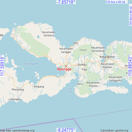
Npongge GPS coordinates[2]
8° 33' 11.16" South, 118° 17' 32.28" East
| Map corner | latitude | longitude |
|---|---|---|
| Upper-left | -7.85718°, | 117.58918° |
| Center: | -8.5531°, | 118.2923° |
| Lower-right: | -9.24775°, | 118.99543° |
| Map W x H: | 154.6×154.6 km | = 96.1×96.1mi |
| max Lat: | 5.88969° ⇑85.4% North |
| Npongge: | -8.5531° |
| min Lat: | ⇓14.6% South -10.934° |
| min Long | Npongge | max Long |
| 95.1345° | 118.2923° | 140.9419° |
| W 79.5%⇐ | ⇒20.5% E |
Elevation
Elevation of Npongge is 127 m = 417 ft, and this is 102.7 m = 337 ft below average elevation for this country.
| Max E: |
3185 m = 10449 ft | 44.6% |
| Avg. | 229.7 m = 754 ft | |
| Npongge | 127 m = 417 ft | |
Min E: |
-1 m = -3 ft | 55.4% |
See also: Indonesia elevation on elevation.city.
Geographical zone
Npongge is located in South Torrid zone (between Equator and Tropic of Capricorn). Distance of Equator is 951 km =590.9 mi to North.| Distance of | km | miles | from Npongge |
|---|---|---|---|
| Equator | 951 | 590.9 | to North |
| Tropic Capricorn | 1654.9 | 1028.3 | to South |
| Antarctic Circle | 6450.2 | 4008 | to South |
| South Pole | 9056 | 5627.1 | to South |


Nearby cities:
15 places around Npongge: (largest is in red/bold)
• Dompu
18.9 km =11.7 mi,  84°
84°
• Kalate
5.1 km =3.2 mi,  283°
283°
• Kambu
18.8 km =11.7 mi,  9°
9°
• Kempo
5 km =3.1 mi, 283°
• Kesi
11.2 km =7 mi, 281°
• Konte
6.5 km =4 mi, 278°
• Lanci Satu
7.2 km =4.5 mi,  22°
22°
• Nusajaya
8.1 km =5 mi, 11°
• Rasabou
4.5 km =2.8 mi,  293°
293°
• Samangawah
6.4 km =4 mi, 6°
• Soriutu
5.1 km =3.2 mi,  41°
41°
• Soro
6 km =3.7 mi,  265°
265°
• Sumur Lima
6.6 km =4.1 mi, 6°
• Taloko
17.1 km =10.6 mi, 8°
• Woja
11.5 km =7.1 mi,  143°
143°
Sources, notices
• [Note1] Compared only with cities in Indonesia existing in our database
• [Src1] Map data: © OpenStreetMap contributors (CC-BY-SA)
• [Src2] Other city data from geonames.org with taken over terms of usage.
• [Src3] Geographical zone / Annual Mean Temperature by Robert A. Rohde @ Wikipedia
