Galubakul geodata
Galubakul (East Nusa Tenggara) is a seat of a fourth-order administrative division; located in Indonesia in Asia/Makassar (GMT+8) time zone. In our database, there are 407 cities with bigger population. Compared to other cities in Indonesia, 94% of cities are located further ↑North; 82% of cities are located further ←West and 80.8% of cities have lower elevation than Galubakul. Note1


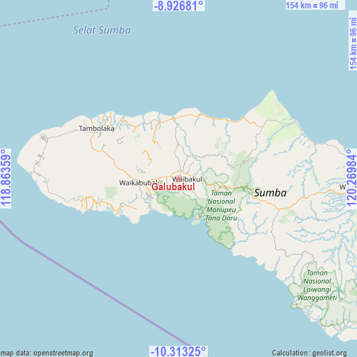
Galubakul GPS coordinates[2]
9° 37' 14.664" South, 119° 34' 0.156" East
| Map corner | latitude | longitude |
|---|---|---|
| Upper-left | -8.92681°, | 118.86359° |
| Center: | -9.62074°, | 119.56671° |
| Lower-right: | -10.31325°, | 120.26984° |
| Map W x H: | 154.2×154.2 km | = 95.8×95.8mi |
| max Lat: | 5.88969° ⇑94% North |
| Galubakul: | -9.62074° |
| min Lat: | ⇓6% South -10.934° |
| min Long | Galubakul | max Long |
| 95.1345° | 119.56671° | 140.9419° |
| W 82%⇐ | ⇒18% E |
Elevation
Elevation of Galubakul is 444 m = 1457 ft, and this is 214.3 m = 703 ft above average elevation for this country.
| Max E: |
3185 m = 10449 ft | 19.2% |
| Galubakul | 444 m 1457 ft | |
| Avg. | 229.7 m = 754 ft | |
Min E: |
-1 m = -3 ft | 80.8% |
See also: Indonesia elevation on elevation.city.
Geographical zone
Galubakul is located in South Torrid zone (between Equator and Tropic of Capricorn). Distance of Equator is 1069.7 km =664.7 mi to North.| Distance of | km | miles | from Galubakul |
|---|---|---|---|
| Equator | 1069.7 | 664.7 | to North |
| Tropic Capricorn | 1536.2 | 954.6 | to South |
| Antarctic Circle | 6331.4 | 3934.1 | to South |
| South Pole | 8937.3 | 5553.4 | to South |


Nearby cities:
15 places around Galubakul: (largest is in red/bold)
• Barabedang
14.6 km =9.1 mi,  236°
236°
• Kabondok
2.4 km =1.5 mi,  13°
13°
• Kalimbukuni
14.4 km =8.9 mi,  263°
263°
• Katikuloko
3.7 km =2.3 mi,  314°
314°
• Lawonda
11 km =6.8 mi, 14°
• Manukaka
3.5 km =2.2 mi,  41°
41°
• Pretana
8.5 km =5.3 mi,  86°
86°
• Tamaau
3.6 km =2.2 mi,  340°
340°
• Tamanaimahu
4.2 km =2.6 mi,  117°
117°
• Tanarara
2.8 km =1.7 mi, 239°
• Tanatoku
11.5 km =7.1 mi, 344°
• Toupopu
13.8 km =8.6 mi,  228°
228°
• Waihibar
6.4 km =4 mi,  79°
79°
• Wailolung
4 km =2.5 mi,  23°
23°
• Weepanapi
14.3 km =8.9 mi,  291°
291°
Sources, notices
• [Note1] Compared only with cities in Indonesia existing in our database
• [Src1] Map data: © OpenStreetMap contributors (CC-BY-SA)
• [Src2] Other city data from geonames.org with taken over terms of usage.
• [Src3] Geographical zone / Annual Mean Temperature by Robert A. Rohde @ Wikipedia
