Tamaau geodata
Tamaau (East Nusa Tenggara) is a seat of a fourth-order administrative division; located in Indonesia in Asia/Makassar (GMT+8) time zone. In our database, there are 407 cities with bigger population. Compared to other cities in Indonesia, 93.8% of cities are located further ↑North; 81.9% of cities are located further ←West and 81.3% of cities have lower elevation than Tamaau. Note1


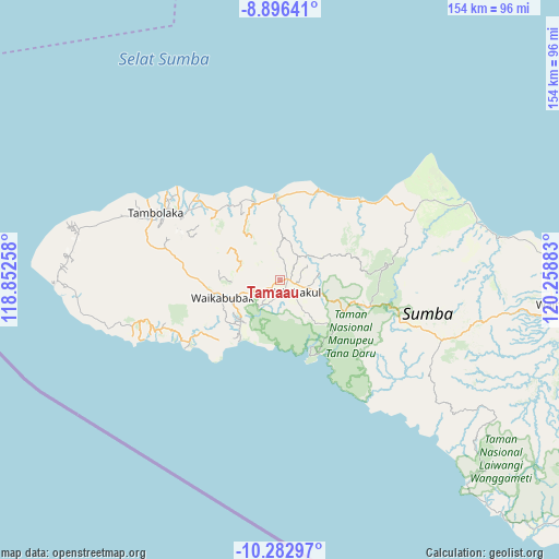
Tamaau GPS coordinates[2]
9° 35' 25.44" South, 119° 33' 20.52" East
| Map corner | latitude | longitude |
|---|---|---|
| Upper-left | -8.89641°, | 118.85258° |
| Center: | -9.5904°, | 119.5557° |
| Lower-right: | -10.28297°, | 120.25883° |
| Map W x H: | 154.2×154.2 km | = 95.8×95.8mi |
| max Lat: | 5.88969° ⇑93.8% North |
| Tamaau: | -9.5904° |
| min Lat: | ⇓6.2% South -10.934° |
| min Long | Tamaau | max Long |
| 95.1345° | 119.5557° | 140.9419° |
| W 81.9%⇐ | ⇒18.1% E |
Elevation
Elevation of Tamaau is 452 m = 1483 ft, and this is 222.3 m = 729 ft above average elevation for this country.
| Max E: |
3185 m = 10449 ft | 18.7% |
| Tamaau | 452 m 1483 ft | |
| Avg. | 229.7 m = 754 ft | |
Min E: |
-1 m = -3 ft | 81.3% |
See also: Indonesia elevation on elevation.city.
Geographical zone
Tamaau is located in South Torrid zone (between Equator and Tropic of Capricorn). Distance of Equator is 1066.4 km =662.6 mi to North.| Distance of | km | miles | from Tamaau |
|---|---|---|---|
| Equator | 1066.4 | 662.6 | to North |
| Tropic Capricorn | 1539.6 | 956.7 | to South |
| Antarctic Circle | 6334.8 | 3936.3 | to South |
| South Pole | 8940.7 | 5555.5 | to South |


Nearby cities:
15 places around Tamaau: (largest is in red/bold)
• Galubakul
3.6 km =2.2 mi,  160°
160°
• Kabondok
2 km =1.2 mi,  119°
119°
• Kalimbukuni
14.1 km =8.8 mi,  248°
248°
• Katikuloko
1.6 km =1 mi,  240°
240°
• Lawonda
8.3 km =5.2 mi,  28°
28°
• Manukaka
3.6 km =2.2 mi,  102°
102°
• Pretana
10.1 km =6.3 mi,  106°
106°
• Tamanaimahu
7.2 km =4.5 mi,  136°
136°
• Tanarara
5 km =3.1 mi,  194°
194°
• Tanatoku
7.9 km =4.9 mi,  346°
346°
• Tebara
14.6 km =9.1 mi, 249°
• Waihibar
7.8 km =4.8 mi, 106°
• Waikambila
14 km =8.7 mi,  62°
62°
• Wailolung
2.9 km =1.8 mi,  83°
83°
• Weepanapi
12.2 km =7.6 mi,  278°
278°
Sources, notices
• [Note1] Compared only with cities in Indonesia existing in our database
• [Src1] Map data: © OpenStreetMap contributors (CC-BY-SA)
• [Src2] Other city data from geonames.org with taken over terms of usage.
• [Src3] Geographical zone / Annual Mean Temperature by Robert A. Rohde @ Wikipedia
