Nggilat geodata
Nggilat (East Nusa Tenggara) is a seat of a fourth-order administrative division; located in Indonesia in Asia/Makassar (GMT+8) time zone. In our database, there are 407 cities with bigger population. Compared to other cities in Indonesia, 77.1% of cities are located further ↑North; 83.5% of cities are located further ←West and 85.2% of cities have higher elevation than Nggilat. Note1


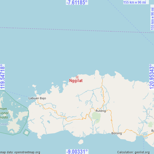
Nggilat GPS coordinates[2]
8° 18' 29.52" South, 120° 15' 1.08" East
| Map corner | latitude | longitude |
|---|---|---|
| Upper-left | -7.61185°, | 119.54718° |
| Center: | -8.3082°, | 120.2503° |
| Lower-right: | -9.00331°, | 120.95343° |
| Map W x H: | 154.7×154.7 km | = 96.1×96.1mi |
| max Lat: | 5.88969° ⇑77.1% North |
| Nggilat: | -8.3082° |
| min Lat: | ⇓22.9% South -10.934° |
| min Long | Nggilat | max Long |
| 95.1345° | 120.2503° | 140.9419° |
| W 83.5%⇐ | ⇒16.5% E |
Elevation
Elevation of Nggilat is 14 m = 46 ft, and this is 215.7 m = 708 ft below average elevation for this country.
| Max E: |
3185 m = 10449 ft | 85.2% |
| Avg. | 229.7 m = 754 ft | |
| Nggilat | 14 m = 46 ft | |
Min E: |
-1 m = -3 ft | 14.8% |
See also: Indonesia elevation on elevation.city.
Geographical zone
Nggilat is located in South Torrid zone (between Equator and Tropic of Capricorn). Distance of Equator is 923.8 km =574 mi to North.| Distance of | km | miles | from Nggilat |
|---|---|---|---|
| Equator | 923.8 | 574 | to North |
| Tropic Capricorn | 1682.1 | 1045.2 | to South |
| Antarctic Circle | 6477.4 | 4024.9 | to South |
| South Pole | 9083.3 | 5644.1 | to South |


Nearby cities:
15 places around Nggilat: (largest is in red/bold)
• Bari
8.9 km =5.5 mi,  237°
237°
• Congkar
17.7 km =11 mi,  79°
79°
• Genang
6.9 km =4.3 mi,  232°
232°
• Kampungbajo
12 km =7.5 mi,  249°
249°
• Lanos
17.7 km =11 mi, 80°
• Nggalak
9 km =5.6 mi,  124°
124°
• Pacar
20.1 km =12.5 mi,  195°
195°
• Pau
16 km =9.9 mi, 203°
• Pering
16.1 km =10 mi,  95°
95°
• Rego
13.2 km =8.2 mi,  177°
177°
• Ruis
21.1 km =13.1 mi,  107°
107°
• Sasa
16.4 km =10.2 mi,  207°
207°
• Toroloji
10.5 km =6.5 mi, 238°
• Wangkung
21.9 km =13.6 mi, 83°
• Wontong
14 km =8.7 mi, 105°
Sources, notices
• [Note1] Compared only with cities in Indonesia existing in our database
• [Src1] Map data: © OpenStreetMap contributors (CC-BY-SA)
• [Src2] Other city data from geonames.org with taken over terms of usage.
• [Src3] Geographical zone / Annual Mean Temperature by Robert A. Rohde @ Wikipedia
