Wangkung geodata
Wangkung (East Nusa Tenggara) is a seat of a fourth-order administrative division; located in Indonesia in Asia/Makassar (GMT+8) time zone. In our database, there are 407 cities with bigger population. Compared to other cities in Indonesia, 76.1% of cities are located further ↑North; 84.1% of cities are located further ←West and 75.5% of cities have higher elevation than Wangkung. Note1


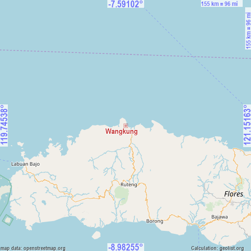
Wangkung GPS coordinates[2]
8° 17' 14.64" South, 120° 26' 54.6" East
| Map corner | latitude | longitude |
|---|---|---|
| Upper-left | -7.59102°, | 119.74538° |
| Center: | -8.2874°, | 120.4485° |
| Lower-right: | -8.98255°, | 121.15163° |
| Map W x H: | 154.7×154.7 km | = 96.1×96.1mi |
| max Lat: | 5.88969° ⇑76.1% North |
| Wangkung: | -8.2874° |
| min Lat: | ⇓23.9% South -10.934° |
| min Long | Wangkung | max Long |
| 95.1345° | 120.4485° | 140.9419° |
| W 84.1%⇐ | ⇒15.9% E |
Elevation
Elevation of Wangkung is 24 m = 79 ft, and this is 205.7 m = 675 ft below average elevation for this country.
| Max E: |
3185 m = 10449 ft | 75.5% |
| Avg. | 229.7 m = 754 ft | |
| Wangkung | 24 m = 79 ft | |
Min E: |
-1 m = -3 ft | 24.5% |
See also: Indonesia elevation on elevation.city.
Geographical zone
Wangkung is located in South Torrid zone (between Equator and Tropic of Capricorn). Distance of Equator is 921.5 km =572.6 mi to North.| Distance of | km | miles | from Wangkung |
|---|---|---|---|
| Equator | 921.5 | 572.6 | to North |
| Tropic Capricorn | 1684.4 | 1046.6 | to South |
| Antarctic Circle | 6479.7 | 4026.3 | to South |
| South Pole | 9085.6 | 5645.5 | to South |


Nearby cities:
15 places around Wangkung: (largest is in red/bold)
• Baru
5.2 km =3.2 mi,  115°
115°
• Baru Timur
5.2 km =3.2 mi, 116°
• Congkar
4.4 km =2.7 mi,  281°
281°
• Dampek
16.1 km =10 mi,  95°
95°
• Lanos
4.4 km =2.7 mi, 277°
• Nggalak
16.2 km =10.1 mi,  242°
242°
• Pering
7 km =4.3 mi, 235°
• Reo
5.1 km =3.2 mi, 119°
• Ruis
8.8 km =5.5 mi,  190°
190°
• Satarteu
8.5 km =5.3 mi, 116°
• Sengari
0.8 km =0.5 mi, 103°
• Senggapi
1.9 km =1.2 mi,  127°
127°
• Tanahputih
4.5 km =2.8 mi, 123°
• Weleng
15.5 km =9.6 mi,  147°
147°
• Wontong
10.2 km =6.3 mi,  234°
234°
Sources, notices
• [Note1] Compared only with cities in Indonesia existing in our database
• [Src1] Map data: © OpenStreetMap contributors (CC-BY-SA)
• [Src2] Other city data from geonames.org with taken over terms of usage.
• [Src3] Geographical zone / Annual Mean Temperature by Robert A. Rohde @ Wikipedia
