Higetegera geodata
Higetegera (East Nusa Tenggara) is a seat of a fourth-order administrative division; located in Indonesia in Asia/Makassar (GMT+8) time zone. In our database, there are 407 cities with bigger population. Compared to other cities in Indonesia, 88% of cities are located further ↑North; 88.7% of cities are located further ←West and 67.4% of cities have higher elevation than Higetegera. Note1


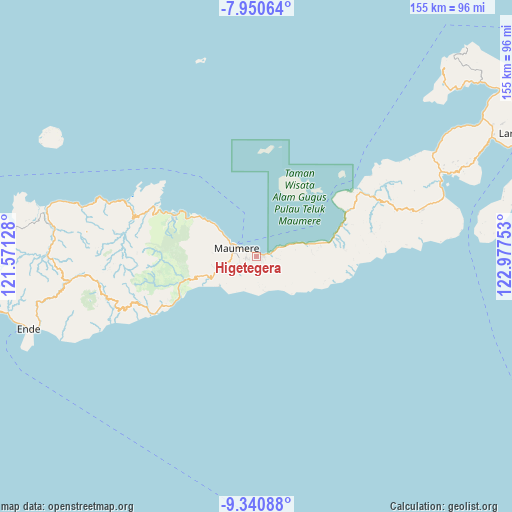
Higetegera GPS coordinates[2]
8° 38' 47.04" South, 122° 16' 27.84" East
| Map corner | latitude | longitude |
|---|---|---|
| Upper-left | -7.95064°, | 121.57128° |
| Center: | -8.6464°, | 122.2744° |
| Lower-right: | -9.34088°, | 122.97753° |
| Map W x H: | 154.6×154.6 km | = 96.1×96.1mi |
| max Lat: | 5.88969° ⇑88% North |
| Higetegera: | -8.6464° |
| min Lat: | ⇓12% South -10.934° |
| min Long | Higetegera | max Long |
| 95.1345° | 122.2744° | 140.9419° |
| W 88.7%⇐ | ⇒11.3% E |
Elevation
Elevation of Higetegera is 37 m = 121 ft, and this is 192.7 m = 632 ft below average elevation for this country.
| Max E: |
3185 m = 10449 ft | 67.4% |
| Avg. | 229.7 m = 754 ft | |
| Higetegera | 37 m = 121 ft | |
Min E: |
-1 m = -3 ft | 32.6% |
See also: Indonesia elevation on elevation.city.
Geographical zone
Higetegera is located in South Torrid zone (between Equator and Tropic of Capricorn). Distance of Equator is 961.4 km =597.4 mi to North.| Distance of | km | miles | from Higetegera |
|---|---|---|---|
| Equator | 961.4 | 597.4 | to North |
| Tropic Capricorn | 1644.5 | 1021.8 | to South |
| Antarctic Circle | 6439.8 | 4001.5 | to South |
| South Pole | 9045.7 | 5620.7 | to South |


Nearby cities:
15 places around Higetegera: (largest is in red/bold)
• Aibura
6.7 km =4.2 mi,  109°
109°
• Baobatun
4.6 km =2.9 mi,  170°
170°
• Bei
6 km =3.7 mi,  183°
183°
• Brai
5.5 km =3.4 mi,  255°
255°
• Detung
6.7 km =4.2 mi,  253°
253°
• Habingkloang
6.5 km =4 mi,  207°
207°
• Ili
3.3 km =2.1 mi,  196°
196°
• Kawapante
2.4 km =1.5 mi,  89°
89°
• Nangahaledoi
5.2 km =3.2 mi,  72°
72°
• Nitakloang
2.6 km =1.6 mi,  133°
133°
• Ojan
6.4 km =4 mi,  193°
193°
• Potet
5.5 km =3.4 mi,  137°
137°
• Waioti
4 km =2.5 mi,  295°
295°
• Waipare
1.1 km =0.7 mi,  25°
25°
• Watuliwung
2.6 km =1.6 mi,  239°
239°
Sources, notices
• [Note1] Compared only with cities in Indonesia existing in our database
• [Src1] Map data: © OpenStreetMap contributors (CC-BY-SA)
• [Src2] Other city data from geonames.org with taken over terms of usage.
• [Src3] Geographical zone / Annual Mean Temperature by Robert A. Rohde @ Wikipedia
