Baobatun geodata
Baobatun (East Nusa Tenggara) is a seat of a fourth-order administrative division; located in Indonesia in Asia/Makassar (GMT+8) time zone. In our database, there are 407 cities with bigger population. Compared to other cities in Indonesia, 89% of cities are located further ↑North; 88.7% of cities are located further ←West and 68.8% of cities have lower elevation than Baobatun. Note1


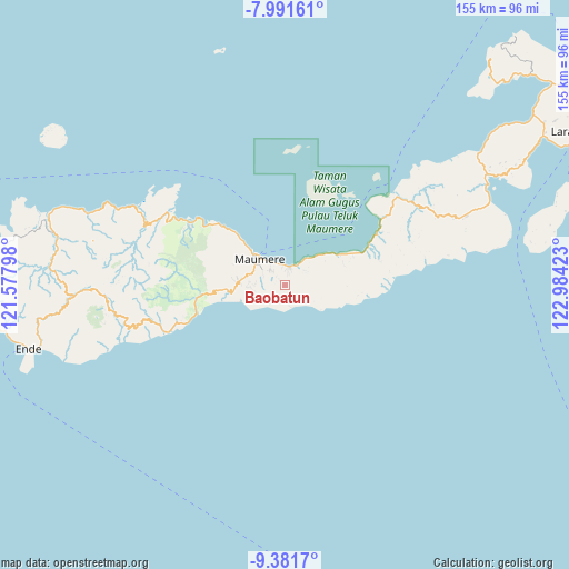
Baobatun GPS coordinates[2]
8° 41' 14.28" South, 122° 16' 51.96" East
| Map corner | latitude | longitude |
|---|---|---|
| Upper-left | -7.99161°, | 121.57798° |
| Center: | -8.6873°, | 122.2811° |
| Lower-right: | -9.3817°, | 122.98423° |
| Map W x H: | 154.6×154.6 km | = 96.1×96.1mi |
| max Lat: | 5.88969° ⇑89% North |
| Baobatun: | -8.6873° |
| min Lat: | ⇓11% South -10.934° |
| min Long | Baobatun | max Long |
| 95.1345° | 122.2811° | 140.9419° |
| W 88.7%⇐ | ⇒11.3% E |
Elevation
Elevation of Baobatun is 276 m = 906 ft, and this is 46.3 m = 152 ft above average elevation for this country.
| Max E: |
3185 m = 10449 ft | 31.2% |
| Baobatun | 276 m 906 ft | |
| Avg. | 229.7 m = 754 ft | |
Min E: |
-1 m = -3 ft | 68.8% |
See also: Indonesia elevation on elevation.city.
Geographical zone
Baobatun is located in South Torrid zone (between Equator and Tropic of Capricorn). Distance of Equator is 965.9 km =600.2 mi to North.| Distance of | km | miles | from Baobatun |
|---|---|---|---|
| Equator | 965.9 | 600.2 | to North |
| Tropic Capricorn | 1640 | 1019 | to South |
| Antarctic Circle | 6435.2 | 3998.6 | to South |
| South Pole | 9041.1 | 5617.9 | to South |


Nearby cities:
15 places around Baobatun: (largest is in red/bold)
• Aibura
6 km =3.7 mi,  67°
67°
• Bei
1.9 km =1.2 mi,  217°
217°
• Habingkloang
3.9 km =2.4 mi,  252°
252°
• Higetegera
4.6 km =2.9 mi,  350°
350°
• Ili
2.2 km =1.4 mi,  309°
309°
• Kawapante
4.9 km =3 mi,  19°
19°
• Kloangrotat
6 km =3.7 mi,  81°
81°
• Nitakloang
3 km =1.9 mi, 22°
• Ojan
2.8 km =1.7 mi,  232°
232°
• Potet
3 km =1.9 mi, 80°
• Taranggatar
5.8 km =3.6 mi,  191°
191°
• Waipare
5.6 km =3.5 mi,  357°
357°
• Watublapi
3.8 km =2.4 mi,  113°
113°
• Watuliwung
4.4 km =2.7 mi,  317°
317°
• Wolokoli
4.5 km =2.8 mi,  180°
180°
Sources, notices
• [Note1] Compared only with cities in Indonesia existing in our database
• [Src1] Map data: © OpenStreetMap contributors (CC-BY-SA)
• [Src2] Other city data from geonames.org with taken over terms of usage.
• [Src3] Geographical zone / Annual Mean Temperature by Robert A. Rohde @ Wikipedia
