Kaliboto geodata
Kaliboto (East Java) is a seat of a fourth-order administrative division; located in Indonesia in Asia/Jakarta (GMT+7) time zone. In our database, there are 407 cities with bigger population. Compared to other cities in Indonesia, 62.9% of cities are located further ↑North; 50.3% of cities are located further →East and 50.6% of cities have higher elevation than Kaliboto. Note1


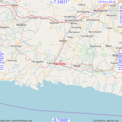
Kaliboto GPS coordinates[2]
8° 2' 35.16" South, 111° 58' 47.64" East
| Map corner | latitude | longitude |
|---|---|---|
| Upper-left | -7.34631°, | 111.27678° |
| Center: | -8.0431°, | 111.9799° |
| Lower-right: | -8.73869°, | 112.68303° |
| Map W x H: | 154.8×154.8 km | = 96.2×96.2mi |
| max Lat: | 5.88969° ⇑62.9% North |
| Kaliboto: | -8.0431° |
| min Lat: | ⇓37.1% South -10.934° |
| min Long | Kaliboto | max Long |
| 95.1345° | 111.9799° | 140.9419° |
| W 49.7%⇐ | ⇒50.3% E |
Elevation
Elevation of Kaliboto is 100 m = 328 ft, and this is 129.7 m = 426 ft below average elevation for this country.
| Max E: |
3185 m = 10449 ft | 50.6% |
| Avg. | 229.7 m = 754 ft | |
| Kaliboto | 100 m = 328 ft | |
Min E: |
-1 m = -3 ft | 49.4% |
See also: Indonesia elevation on elevation.city.
Geographical zone
Kaliboto is located in South Torrid zone (between Equator and Tropic of Capricorn). Distance of Equator is 894.3 km =555.7 mi to North.| Distance of | km | miles | from Kaliboto |
|---|---|---|---|
| Equator | 894.3 | 555.7 | to North |
| Tropic Capricorn | 1711.6 | 1063.5 | to South |
| Antarctic Circle | 6506.9 | 4043.2 | to South |
| South Pole | 9112.8 | 5662.4 | to South |


Nearby cities:
15 places around Kaliboto: (largest is in red/bold)
• Balong
2.7 km =1.7 mi,  296°
296°
• Bangoan
4.3 km =2.7 mi,  268°
268°
• Bulusari
3.4 km =2.1 mi,  256°
256°
• Jati
2.8 km =1.7 mi,  238°
238°
• Kedungdoro
3.7 km =2.3 mi, 243°
• Mayangan
2.7 km =1.7 mi,  280°
280°
• Ngamba
3.2 km =2 mi,  11°
11°
• Ngrawan
1 km =0.6 mi,  352°
352°
• Ngrukem
3.9 km =2.4 mi,  180°
180°
• Pakel
3 km =1.9 mi,  160°
160°
• Pucung
1.3 km =0.8 mi,  213°
213°
• Salam
2 km =1.2 mi, 347°
• Sambirobyong
2.7 km =1.7 mi, 205°
• Tambakrejo
4 km =2.5 mi,  334°
334°
• Tawangrejo
1.7 km =1.1 mi,  61°
61°
Sources, notices
• [Note1] Compared only with cities in Indonesia existing in our database
• [Src1] Map data: © OpenStreetMap contributors (CC-BY-SA)
• [Src2] Other city data from geonames.org with taken over terms of usage.
• [Src3] Geographical zone / Annual Mean Temperature by Robert A. Rohde @ Wikipedia
