Rejoagung geodata
Rejoagung (East Java) is a seat of a fourth-order administrative division; located in Indonesia in Asia/Jakarta (GMT+7) time zone. In our database, there are 407 cities with bigger population. Compared to other cities in Indonesia, 63% of cities are located further ↑North; 51.1% of cities are located further →East and 53% of cities have higher elevation than Rejoagung. Note1


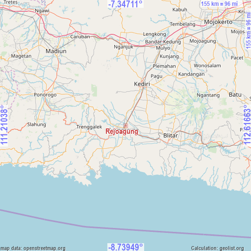
Rejoagung GPS coordinates[2]
8° 2' 38.04" South, 111° 54' 48.6" East
| Map corner | latitude | longitude |
|---|---|---|
| Upper-left | -7.34711°, | 111.21038° |
| Center: | -8.0439°, | 111.9135° |
| Lower-right: | -8.73949°, | 112.61663° |
| Map W x H: | 154.8×154.8 km | = 96.2×96.2mi |
| max Lat: | 5.88969° ⇑63% North |
| Rejoagung: | -8.0439° |
| min Lat: | ⇓37% South -10.934° |
| min Long | Rejoagung | max Long |
| 95.1345° | 111.9135° | 140.9419° |
| W 48.9%⇐ | ⇒51.1% E |
Elevation
Elevation of Rejoagung is 92 m = 302 ft, and this is 137.7 m = 452 ft below average elevation for this country.
| Max E: |
3185 m = 10449 ft | 53% |
| Avg. | 229.7 m = 754 ft | |
| Rejoagung | 92 m = 302 ft | |
Min E: |
-1 m = -3 ft | 47% |
See also: Indonesia elevation on elevation.city.
Geographical zone
Rejoagung is located in South Torrid zone (between Equator and Tropic of Capricorn). Distance of Equator is 894.4 km =555.8 mi to North.| Distance of | km | miles | from Rejoagung |
|---|---|---|---|
| Equator | 894.4 | 555.8 | to North |
| Tropic Capricorn | 1711.5 | 1063.5 | to South |
| Antarctic Circle | 6506.8 | 4043.1 | to South |
| South Pole | 9112.7 | 5662.4 | to South |


Nearby cities:
15 places around Rejoagung: (largest is in red/bold)
• Bago
2.8 km =1.7 mi,  190°
190°
• Bangoan
3 km =1.9 mi,  90°
90°
• Gendingsari
1.8 km =1.1 mi,  345°
345°
• Kanugrahan
1.7 km =1.1 mi,  245°
245°
• Kedungtaman
1.2 km =0.7 mi, 190°
• Kedungwaru
2.6 km =1.6 mi,  172°
172°
• Kepatihan
2.1 km =1.3 mi,  180°
180°
• Majan
1.3 km =0.8 mi,  292°
292°
• Mekarsari
2.6 km =1.6 mi,  154°
154°
• Ringinagung
2.8 km =1.7 mi,  132°
132°
• Sembung
2.7 km =1.7 mi,  225°
225°
• Simo Satu
1.4 km =0.9 mi,  304°
304°
• Tapan
2.2 km =1.4 mi,  57°
57°
• Tulungagung
2.7 km =1.7 mi,  206°
206°
• Winong
1.5 km =0.9 mi,  269°
269°
Sources, notices
• [Note1] Compared only with cities in Indonesia existing in our database
• [Src1] Map data: © OpenStreetMap contributors (CC-BY-SA)
• [Src2] Other city data from geonames.org with taken over terms of usage.
• [Src3] Geographical zone / Annual Mean Temperature by Robert A. Rohde @ Wikipedia
