Penengahan geodata
Penengahan (Lampung) is a seat of a third-order administrative division; located in Indonesia in Asia/Jakarta (GMT+7) time zone. In our database, there are 407 cities with bigger population. Compared to other cities in Indonesia, 88.1% of cities are located further ↓South; 94% of cities are located further →East and 50.6% of cities have higher elevation than Penengahan. Note1


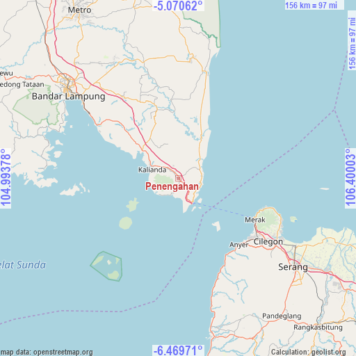
Penengahan GPS coordinates[2]
5° 46' 14.16" South, 105° 41' 48.84" East
| Map corner | latitude | longitude |
|---|---|---|
| Upper-left | -5.07062°, | 104.99378° |
| Center: | -5.7706°, | 105.6969° |
| Lower-right: | -6.46971°, | 106.40003° |
| Map W x H: | 155.6×155.6 km | = 96.7×96.7mi |
| max Lat: | 5.88969° ⇑11.9% North |
| Penengahan: | -5.7706° |
| min Lat: | ⇓88.1% South -10.934° |
| min Long | Penengahan | max Long |
| 95.1345° | 105.6969° | 140.9419° |
| W 6%⇐ | ⇒94% E |
Elevation
Elevation of Penengahan is 100 m = 328 ft, and this is 129.7 m = 426 ft below average elevation for this country.
| Max E: |
3185 m = 10449 ft | 50.6% |
| Avg. | 229.7 m = 754 ft | |
| Penengahan | 100 m = 328 ft | |
Min E: |
-1 m = -3 ft | 49.4% |
See also: Indonesia elevation on elevation.city.
Geographical zone
Penengahan is located in South Torrid zone (between Equator and Tropic of Capricorn). Distance of Equator is 641.6 km =398.7 mi to North.| Distance of | km | miles | from Penengahan |
|---|---|---|---|
| Equator | 641.6 | 398.7 | to North |
| Tropic Capricorn | 1964.3 | 1220.6 | to South |
| Antarctic Circle | 6759.5 | 4200.2 | to South |
| South Pole | 9365.4 | 5819.4 | to South |


Nearby cities:
15 places around Penengahan: (largest is in red/bold)
• Ciparay
44.4 km =27.6 mi,  155°
155°
• Curug
42.7 km =26.5 mi,  123°
123°
• Jabung
34.3 km =21.3 mi,  354°
354°
• Kalianda
12.2 km =7.6 mi,  287°
287°
• Kopibaru
47.7 km =29.6 mi, 155°
• Kopibera
47 km =29.2 mi, 155°
• Kubangkepuh
39.4 km =24.5 mi,  111°
111°
• Labuhanmaringgai
48.3 km =30 mi,  14°
14°
• Mekarsari
46.6 km =29 mi,  150°
150°
• Pakuncen
46.2 km =28.7 mi, 116°
• Palas
13.3 km =8.3 mi, 351°
• Pangarengan
46.4 km =28.8 mi, 116°
• Pasuruan
3.5 km =2.2 mi,  320°
320°
• Sidorejo
28.2 km =17.5 mi, 317°
• Tawingmuara
47.1 km =29.3 mi, 158°
Sources, notices
• [Note1] Compared only with cities in Indonesia existing in our database
• [Src1] Map data: © OpenStreetMap contributors (CC-BY-SA)
• [Src2] Other city data from geonames.org with taken over terms of usage.
• [Src3] Geographical zone / Annual Mean Temperature by Robert A. Rohde @ Wikipedia
