Pematangluhur geodata
Pematangluhur (Banten) is a seat of a fourth-order administrative division; located in Indonesia in Asia/Jakarta (GMT+7) time zone. In our database, there are 407 cities with bigger population. Compared to other cities in Indonesia, 77.4% of cities are located further ↓South; 94.2% of cities are located further →East and 65.2% of cities have lower elevation than Pematangluhur. Note1


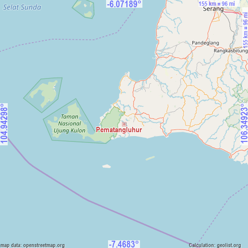
Pematangluhur GPS coordinates[2]
6° 46' 14.16" South, 105° 38' 45.96" East
| Map corner | latitude | longitude |
|---|---|---|
| Upper-left | -6.07189°, | 104.94298° |
| Center: | -6.7706°, | 105.6461° |
| Lower-right: | -7.4683°, | 106.34923° |
| Map W x H: | 155.3×155.3 km | = 96.5×96.5mi |
| max Lat: | 5.88969° ⇑22.6% North |
| Pematangluhur: | -6.7706° |
| min Lat: | ⇓77.4% South -10.934° |
| min Long | Pematangluhur | max Long |
| 95.1345° | 105.6461° | 140.9419° |
| W 5.8%⇐ | ⇒94.2% E |
Elevation
Elevation of Pematangluhur is 224 m = 735 ft, and this is 5.7 m = 19 ft below average elevation for this country.
| Max E: |
3185 m = 10449 ft | 34.8% |
| Avg. | 229.7 m = 754 ft | |
| Pematangluhur | 224 m = 735 ft | |
Min E: |
-1 m = -3 ft | 65.2% |
See also: Indonesia elevation on elevation.city.
Geographical zone
Pematangluhur is located in South Torrid zone (between Equator and Tropic of Capricorn). Distance of Equator is 752.8 km =467.8 mi to North.| Distance of | km | miles | from Pematangluhur |
|---|---|---|---|
| Equator | 752.8 | 467.8 | to North |
| Tropic Capricorn | 1853.1 | 1151.5 | to South |
| Antarctic Circle | 6648.4 | 4131.1 | to South |
| South Pole | 9254.2 | 5750.3 | to South |


Nearby cities:
15 places around Pematangluhur: (largest is in red/bold)
• Cangkeuteuk Sabrang
5.4 km =3.4 mi,  335°
335°
• Ciburial
5.7 km =3.5 mi,  23°
23°
• Cicadas
6.3 km =3.9 mi,  163°
163°
• Cihaur
7.3 km =4.5 mi,  100°
100°
• Cikadu
6.6 km =4.1 mi,  65°
65°
• Cinyurup
5.4 km =3.4 mi, 97°
• Citeluk
4.1 km =2.5 mi,  131°
131°
• Ciunil Barat
8.4 km =5.2 mi,  13°
13°
• Leuwibuaya
7.3 km =4.5 mi, 128°
• Pasirnangka
2.8 km =1.7 mi,  223°
223°
• Polos
7.8 km =4.8 mi,  2°
2°
• Rancasadang
4.2 km =2.6 mi, 66°
• Sindanglaya
3.6 km =2.2 mi, 98°
• Sukapura
8.3 km =5.2 mi,  84°
84°
• Tugu Hilir
4.7 km =2.9 mi,  203°
203°
Sources, notices
• [Note1] Compared only with cities in Indonesia existing in our database
• [Src1] Map data: © OpenStreetMap contributors (CC-BY-SA)
• [Src2] Other city data from geonames.org with taken over terms of usage.
• [Src3] Geographical zone / Annual Mean Temperature by Robert A. Rohde @ Wikipedia
