Gunungjulang geodata
Gunungjulang (Banten) is a seat of a fourth-order administrative division; located in Indonesia in Asia/Jakarta (GMT+7) time zone. In our database, there are 407 cities with bigger population. Compared to other cities in Indonesia, 82.2% of cities are located further ↓South; 87.8% of cities are located further →East and 90% of cities have lower elevation than Gunungjulang. Note1


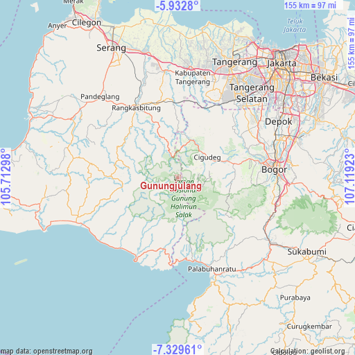
Gunungjulang GPS coordinates[2]
6° 37' 54.12" South, 106° 24' 57.96" East
| Map corner | latitude | longitude |
|---|---|---|
| Upper-left | -5.9328°, | 105.71298° |
| Center: | -6.6317°, | 106.4161° |
| Lower-right: | -7.32961°, | 107.11923° |
| Map W x H: | 155.3×155.3 km | = 96.5×96.5mi |
| max Lat: | 5.88969° ⇑17.8% North |
| Gunungjulang: | -6.6317° |
| min Lat: | ⇓82.2% South -10.934° |
| min Long | Gunungjulang | max Long |
| 95.1345° | 106.4161° | 140.9419° |
| W 12.2%⇐ | ⇒87.8% E |
Elevation
Elevation of Gunungjulang is 641 m = 2103 ft, and this is 411.3 m = 1349 ft above average elevation for this country.
| Max E: |
3185 m = 10449 ft | 10% |
| Gunungjulang | 641 m 2103 ft | |
| Avg. | 229.7 m = 754 ft | |
Min E: |
-1 m = -3 ft | 90% |
See also: Indonesia elevation on elevation.city.
Geographical zone
Gunungjulang is located in South Torrid zone (between Equator and Tropic of Capricorn). Distance of Equator is 737.4 km =458.2 mi to North.| Distance of | km | miles | from Gunungjulang |
|---|---|---|---|
| Equator | 737.4 | 458.2 | to North |
| Tropic Capricorn | 1868.5 | 1161 | to South |
| Antarctic Circle | 6663.8 | 4140.7 | to South |
| South Pole | 9269.7 | 5759.9 | to South |


Nearby cities:
15 places around Gunungjulang: (largest is in red/bold)
• Bojongsarung
3.4 km =2.1 mi,  287°
287°
• Cigebrok
8.9 km =5.5 mi,  326°
326°
• Cikarae
9 km =5.6 mi,  335°
335°
• Cikomara
7.1 km =4.4 mi,  355°
355°
• Cikuning
9.2 km =5.7 mi,  247°
247°
• Ciladaeun
1.6 km =1 mi,  306°
306°
• Cileuksa
4.5 km =2.8 mi,  45°
45°
• Cipanas
9.3 km =5.8 mi,  347°
347°
• Ciparasi
8.6 km =5.3 mi, 247°
• Cipatat
8.8 km =5.5 mi,  83°
83°
• Cisarua
6.5 km =4 mi,  111°
111°
• Jaha
5 km =3.1 mi, 353°
• Maja
6.4 km =4 mi, 245°
• Padurung
5.7 km =3.5 mi, 330°
• Pasirmadang
7.8 km =4.8 mi,  61°
61°
Sources, notices
• [Note1] Compared only with cities in Indonesia existing in our database
• [Src1] Map data: © OpenStreetMap contributors (CC-BY-SA)
• [Src2] Other city data from geonames.org with taken over terms of usage.
• [Src3] Geographical zone / Annual Mean Temperature by Robert A. Rohde @ Wikipedia
